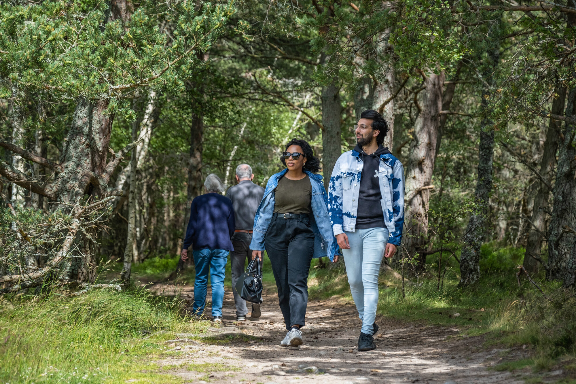
Skip to content
 

Community Paths and Trails

There are over a hundred community paths and trails across the Park to explore at your leisure throughout the year. This guide will give you everything you need to know about the community paths and trails in the towns and villages across the Park.

Use the interactive map to find a walk or download a community path leaflet below.

Use our interactive map

Use the filters below to search for a walk by location, type of walk or difficulty level.

Community Path leaflets


Atholl * Aviemore * Ballater * Boat of Garten * Braemar * Carrbridge * DalwhinnieDulnain Bridge * Glen Clova * Glen Esk * Grantown-on-Spey * KincraigKingussie * Laggan * Nethy Bridge * Newtonmore * Strathdon * Tomintoul


Atholl

Atholl from leafletAtholl is a beautiful blend of rivers, forests, glens and mountains making it a great place to go walking, these 6 walks have been specifically selected for their local flavour.

Enjoy 6 different trails ranging from 1 mile to 4 miles through the woods to the Witches Rock and Wishing Well, past native birch to take in the commanding position of Blair Castle or walk along the River Garry and keep an eye out for leaping salmon.

The Atholl Trails leaflet gives details on all 6 walks including maps and further information about the area.


Back to top


 Aviemore

AviemoreNestled at the heart of Strathspey Aviemore is a vibrant and exciting place to visit, a great place to make connections and a hub for all sorts of outdoor activities. Turn around in any direction and you’ll see a backdrop of high mountains, forests and the River Spey.

There are 6 paths including the short 15 minute Woodland Trail and the longer 2 hour Viewpoint Trail that will see you climb high above the woods for the best views in the Park.

The Aviemore Paths leaflet gives details on all 6 walks including maps and further information about the area.


Back to top


Ballater

Ballater from leafletRenowned for its Royal connections, Ballater lies on a meander of the River Dee under the shelter of Craigendarroch. A network of paths and tracks lead out of the village and offer a variety of routes to enjoy with fine views, rich local history and abundant wildlife.

With 4 different paths to choose from including the 5 mile long Deeside Way which will take you up to 3 hours or the circular Pannanich Woods walk where you might just see a Capercaillie, there’s a bit for all type of walker in Ballater.

The Ballater Paths Leaflet gives details on all 4 walks including maps and further information about the area.

** Flood damage – Diversion in place on Seven Bridges walk. More details **

Back to top


Boat of Garten

Loch Garten towards the Cairngorms

A peaceful highland village on the River Spey, with abundant wildlife, magnificent scenery and the hub of the Strathspey Railway. The network of paths and tracks mean you can leave the car behind and enjoy the circular routes, fine views, rich local history and native wildlife.

You’ll be spoilt for choice in Boat of Garten with 8 different community trails to choose from, including the Osprey Trail which will lead you right past the Osprey Centre at Loch Garten.

The Boat of Garten Paths leaflet gives details on all 8 walks including maps and further information about the area.


Back to top


Braemar

 Braemar landscape, looking towards Ballater.There’s something for all tastes in Braemar, from a gentle stroll by the River Dee to a strenuous hike for one of the best views of Deeside. The routes up Morrone or the lower Creag Choinnich follow in the steps of competitors at Braemar’s famous gathering, and from other route’s you’ll see Braemar Castle.

There are 6 great paths to walk from 6 miles to 2 miles, lasting all day or just part of the day.

The Braemar Paths leaflet gives you details on all 6 walks including maps and further information about the area.

Back to top


Carrbridge

Carr-bridge from leaflet croppedAs you will discover, Carrbridge is a village of many short and pleasant walks. In particular the woods contain a variety of mature and young trees and are home to many of the area’s specialities such as Scottish crossbill, crested tit and red squirrel.

There are 7 trails including 30 minute walks along the River Dulnain or through the Glencharnoch woods, take the longer Calderwood viewpoint trail and you will be delighted by incredible sights across the Cairngorms or take in the famous Sluggan Bridge built by General Wade’s redcoats in the 1700s.
The Carrbridge Path Leaflet gives you details on all 7 walks including maps and further information about the area.


Back to top


Dalwhinnie

issue 9 Dalwhinnie distillerySurrounded by mountains and the at the head of Loch Ericht, Dalwhinnie lays claim to be the highest village in the Scottish Highlands, and while it might be the coldest inhabited place in Britain, the village has always prided itself on offering a warm welcome to travellers.

There are four trails that take in all the sights of Dalwhinnie from the Coachan Wood Viewpoint (3.5 miles) the Distillery Walk (1 mile), Forest Walk (3.5 miles) and the Loch Ericht Walk (1.5 miles).

The Dalwhinnie Trails leaflet gives you details on all 4 walks including maps and further information about the area.

**The Ben Alder level crossing is closed. This means a diversion to the railway underpass is required to reach the start point for the walks. More information see Path closures page.**


Back to top


Dulnain Bridge

Dulnain Bridge from leafletIn Gaelic, Dulnain, is split into two parts with ‘Dul’ meaning ‘field or flat open place’ and ‘nain’ referring to ‘by the river’. Dulnain Bridge and the crofting community of Skye-of-Curr to the south, retains much of its original character and take great pride in the welcome they give to visitors.

The 5 different walks will showcase the sights of the Muckrach Castle, the Roche Moutonnees, red squirrels and the incredible braes of Abernethy.

The Dulnain Bridge Paths leaflet gives you details on all 5 walks including maps and further information about the area.


Back to top


Glen Clova

Glen ClovaGlen Clova is one of a series of steep-sided glens that together with Glen Isla, Prosen, Lethnot and Esk form the Angus Glens. There are a number of trails and paths you can explore from low level routes through forests to more strenuous expeditions onto the hills with the reward of fine views.

With 7 different walks to choose from you could spend many a day exploring Glen Clova. From the 6 mile long Minister’s Path that links Glen Clova and Glen Prosen to the easier but equally rewarding South Esk Trail that loops around the River South Esk with fantastic views into the upper glen that will take you around an hour.

The Glen Clova Paths leaflet gives you details on all 7 walks including maps and further information about the area.


Back to top


Glen Esk

Glen Esk from leaflet croppedGlen Esk is one of a series of steep-sided glens that together with Glen Isla, Prosen, Lethnot and Clova form the Angus Glens. In the upper valley there are numerous corries and waterfalls, rich with local history, abundant wildlife and a chance to see mountain plants and animals.

There are 4 walks ranging from 3 miles to 10 miles. Follow the Edzell to Rocks of Solitude path for impressive views or take in the Invermark to Loch Lee, Falls of Unich and Falls of Damff for a truly exciting expedition into the hills past the fortified towers of Invermark Castle and onto two spectacular waterfalls.

The Glen Esk Paths leaflet gives you details on all 4 walks including maps and further information about the area.


Back to top


Grantown-on-Spey

3. Woodland walk The trails in Grantown will take you through natural ancient woodland with Scots Pine, Birch, Rowan, Willow, Aspen and Bird Cherry, as well as shrubs of Hazel and Juniper. From the viewpoint you can see the entire Cairngorms Range.

With 8 different paths to take you through the Beachen and Anagach Woods, the mix of trails is perfect for those who have 3 hours to explore or those who only have half an hour. The Beachen Woods will take you up high to see some of the most spectacular panoramas of the Cairngorms, while Anagach is network of relatively flat forest paths that wind through some of the most impressive woodland in the UK.

The Grantown-on-Spey Paths leaflet gives you details on all 8 walks including maps and further information about the area.


Back to top


Kincraig

image of Uath lochan

The village of Kincraig sits on the shores of Loch Insh and at the foot of Glen Feshie and features a range of trails from shorter strolls through woodland and around lochans to climbs up to spectacular viewpoints.

There are four trails around the village of Kincraig itself, with a further four paths at nearby Feshiebridge (1.5 miles) including the Frank Bruce Sculpture Trail.  Alternatively park at Inshriach Forest and enjoy the popular short trail around the Uath Lochans or the steady climb up Farleitter Crag for some stunning views. The Torr Alvie walk starting from the Dalraddy Holiday Park is another great viewpoint walk – it’s worth the climb to reach the Duke of Gordon’s monument and panoramic views.

The Kincraig Paths leaflet gives you details on all 11 paths including maps.


Back to top


Kingussie

KingussieA network of paths and tracks lead out of the village providing a variety of circular routes to enjoy with fine views, a rich local history and abundant wildlife. The routes, of varying lengths, all start and finish in Kingussie so you can give the car a rest.

The Golf Course Circular will take you on a tour of Kingussie, the birch woodland, past Loch Gynack and the Glen Gynack Township, while the West Terrace Circular will take you past impressive 19th Century villas along quiet roadways as well as lead you to some impressive views of the Spey Valley. There are 6 paths in all to explore.

The Kingussie Paths Leaflet gives you details on all 6 walks including maps and further information about the area.


Back to top


Laggan

LagganFor centuries Laggan has occupied a strategic position at the centre of Scotland’s mainland, with strong lines of communication. Historically, travellers, soldiers, cattle drovers and pack-horse teams found a warm welcome here. The area boasts fine views, stunning waterfalls and an abundance of wildlife.

Laggan tops the community paths charts with 10 different trails to explore. Don’t miss out on seeing the Centre of Scotland Stone on the Glentruim Forest Loop or pick one of trails that will take you to the Falls of Pattack. Some routes will take you less than half an hour while others are a more long haul, lasting around 3 hours.

The Laggan Paths Leaflet gives you details on all 10 walks including maps and further information about the area.


Back to top


Nethy Bridge

Nethy Bridge from leafletThe village of Nethy Bridge on the River Nethy beside the historic Abernethy Forest with the impressive background of the Cairngorm Mountains, has a network of way-marked paths, including an all-abilities trail, letting you explore the Abernethy area at your leisure.

If history is your thing then the Castle Roy loop (3.5 miles) will take you past the ruins of the 13th Century fortress; Castle Roy. For those who like a bit of trainspotting, then the Puggy Line Trail would be ideal, a 2.5 mile walk following the route of an old logging railway line that will take you past the Abernethy National Nature Reserve.

The Nethy Bridge Paths leaflet gives you details on all 9 walks including maps and further information about the area.


Back to top


Newtonmore

Newtonmore from leafletLocated close to the centre of Scotland, Newtonmore sits at the mouth of Glen Banchor surrounded by high mountains and commanding fantastic views up and down Badenoch. A true highland village in every sense of the word, Newtonmore is famous for shinty, the Clan Macpherson and is a great place to enjoy the outdoors.

Head off on an adventure on the Wildcat Trail, an orbital village route that will have you take in woodland, gorge, river and moorland. Then there is the popular Dalchurn Bridge walk that takes you from the village and up into the beautiful Glen Banchor, or follow the Milk Cow path for a short walk through the village – and be sure to look out for those elusive wildcats!

The Newtonmore Paths leaflet gives you details on all 7 walks including maps and further information about the area.


Back to top


Strathdon

Strathdon/CorgarffStrathdon sits at the meeting of the River Don and the waters of the Nochty. The immediate area of Strathdon is one of contrast with fertile strath (low lying land beside the river) leading to the wilder, more rugged landscape of the Cairngorms.

With 6 walks to choose from you can explore the ‘backstreets’ of Strathdon, ascend to the summit of Ben Newe or catch sight of leaping salmon from the River Don. Walks range from 1 mile to 4 miles and take in a variety of habitats and wildlife.

The Strathdon Trails leaflet gives you details on all 6 walks including maps and further information about the area.


Back to top


Tomintoul

Still viewpoint in Tomintoul Another contender for highest village in the Highlands, Tomintoul sits at 1,165 feet above sea level on the northern slopes of the Cairngorm Mountains. Coming from the Gaelic word meaning “the mound of the barn” or “the barn knoll”, Tomintoul was founded in the late 1700s and is a great example of a 18th century Scottish planned village.

Choose from 6 walks around the area including the Bridge of Avon Link and walk through woodland and farmland to the Old Bridge of Avon, lasting around 2 hours. While the Tomintoul Circular Walk gives fine views of the surrounding landscape in Tomintoul and opportunities to see wader birds in spring.

The Tomintoul Trails leaflet gives you details on all 6 walks including maps and further information about the area.

Back to top


Select an activity

Choose your activities