


Path closures
Paths and trails may need to be closed from time to time for reasons such as being in an unsafe condition following storm damage, flooding, unavoidable maintenance work or land management operations e.g. tree felling.
Please always be vigilant when visiting the countryside and follow all signage and directions for your own safety.
This page will be kept as up to date as possible, however we recommend checking directly with the relevant ranger service, estate, website or social media for the latest advice.
Alert
Relevant alerts
-
There is an ongoing wildfire situation at Glenmore within the Cairngorms National Park. Click here for all the latest. We would encourage members of the public to follow current guidance and be aware that the situation may change.
-
Very high fire risk - 15 to 20 July
The Scottish Fire and Rescue Service has issued a very high wildfire warning impacting areas of the National Park on Wednesday 15 until Monday 20 July. If you are out and about in the Cairngorms National Park please observe the following guidance:
- Do not light any fire or barbecue, in line with the new fire byelaw
- Always ensure cigarettes are fully extinguished and take your litter (including glass) away with you
- Enjoy the outdoors responsibly - most wildfires are caused by human activity
- Stay alert - with dry vegetation and warm weather, fires can start easily, spread rapidly, and burn intensely
- If you see a wildfire, dial 999
For further updates on wildfire risk across Scotland, visit the Scottish Fire and Rescue Service website. To find out more about the fire byelaw, and to see your questions answered, visit our fire byelaw page here.
-
The riverside loop on the Seven Bridges Walk, between Bridge of Gairn and the junction near Polhollick Bridge is closed due to a section washing away in flooding. An alternate route is already shown as part of the walk route, please use this alternate high route parallel to the A93 instead.
-
The railway level crossing at Dalwhinnie – at the walkers car park NN 633 846 – has been closed by Network Rail. An alternative point to cross the railway is via the underpass to the south at the Ben Alder cottages (NN 634 841). More information.
- Dalwhinnie waymarked walks:
- the Loch Ericht Walk loop is no longer possible due to the level crossing closure
- to reach the start of the Forest Walk and Coachan Wood Viewpoint the above diversion to the railway underpass is required
- Dalwhinnie waymarked walks:
-
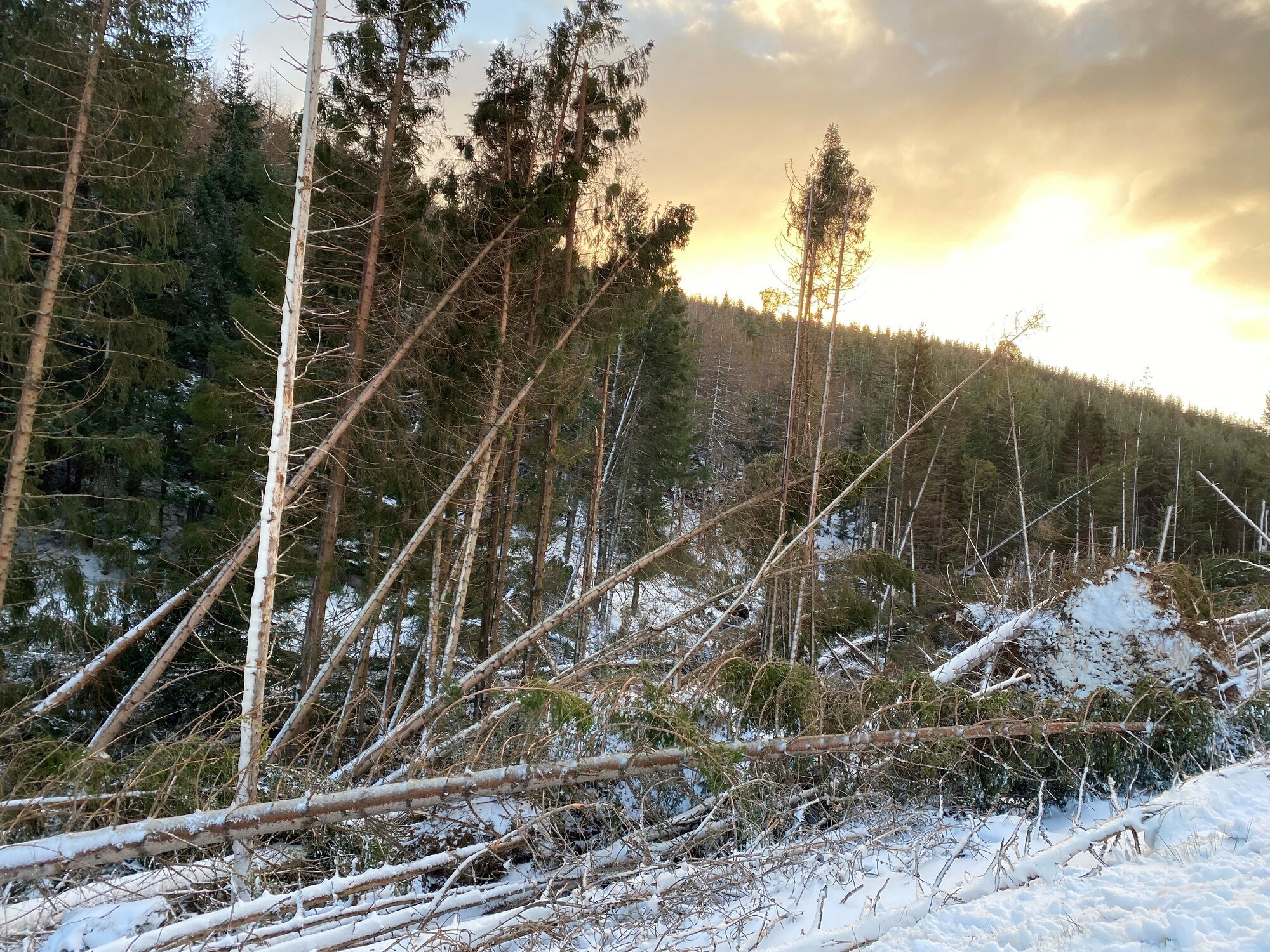
Significant storm damage and windblown trees from the winter storms – clearance works underway but still many restrictions and path closures.
Check Forest and Land Scotland website for latest updates.
- Glen Doll car park – open
- Waymarked trails – Corrie Fee (Green) trail – open.
- ALL OTHER WAYMARKED TRAILS ARE CLOSED.
South Esk trail (Yellow), White Water Trail (White) Jocks Rd and Dounalt Trail (Blue) are all CLOSED due to windblown trees. - Mountain access routes update – Kilbo path is open, Corrie Fee Path is open, Dounalt Road is open (south side of upper White Water – this is an alternative for Jocks road, which remains closed).
- The Capel Road Track is blocked with trees at OS Grid Ref: NO 2841 7717. This may be bypassed by walking along the forest boundary wall between NO 2834 7763 to NO 2872 7771. Conditions on this alternative route are steep, rocky and rough underfoot.
- Ministers Path – northern branch blocked by fallen trees below Elf Hillock. Alternative to follow southern branch.
Additional information: