


Archaeology
You'll find more than heather and granite across the Cairngorms National Park, which spans 4,528 square kilometres. Endless archaeological sites hint at the area's history and the people who’ve inhabited it for thousands of years. Keep scrolling to start excavating.
The Mesolithic period
On the banks of rivers and lochs, archaeologists have discovered flint tools belonging to some of the earliest settlers in the region. These hunter-gatherers lived in camps during the Mesolithic period, over 8,000 years ago. The precision of these tools, which were once wielded for fishing and hunting deer, reveals the hardiness needed to survive in a wilder Cairngorms National Park.
Archaeologists have also uncovered Mesolithic clues, including by-products of stone tools, near Sgòr an Eòin in Glen Dee - a remote, flat river terrace. These deposits lie along the Lairig Ghru mountain pass, which links the east and west sides of the Cairngorms and point to the most popular resting places for travellers of that era.
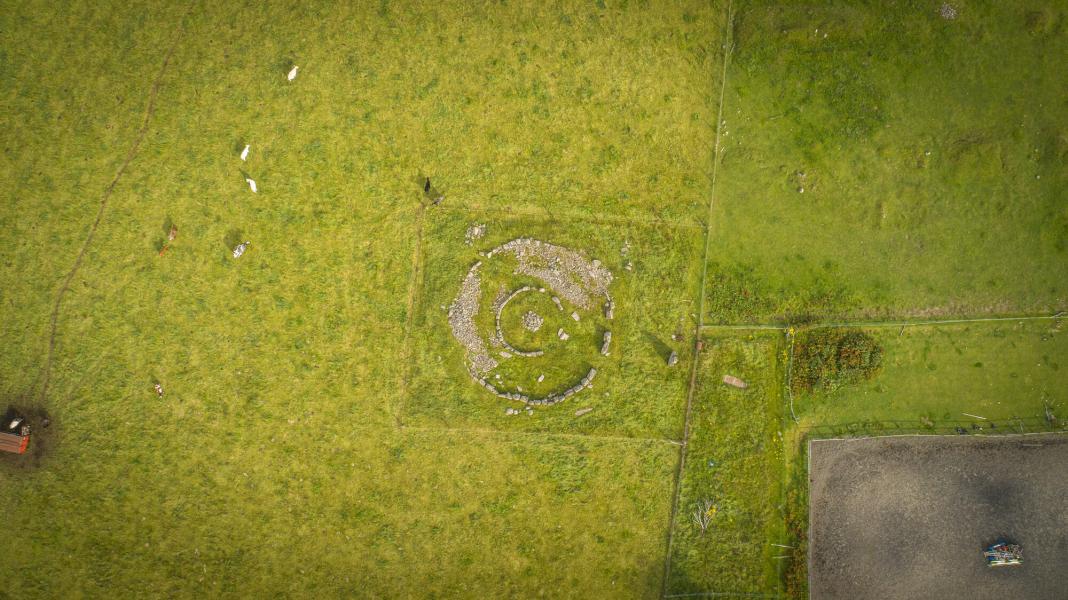
A short way from the Speyside Way is Loch Nan Carraigean cairn, a 5,000 year old Neolithic burial cairn. This cairn, which is near Aviemore, once had a surrounding circle of standing stones but most are now missing. Folklore suggests it was a significant site where kings of Pictland were selected and crowned in Druidic ceremonies.
The Iron Age and the Picts
Fast forward to the Iron Age (800 BC to 400 AD), and Pictish communities began to settle here. Celtic in origin, the Picts left their mark through settlements as well as tools.
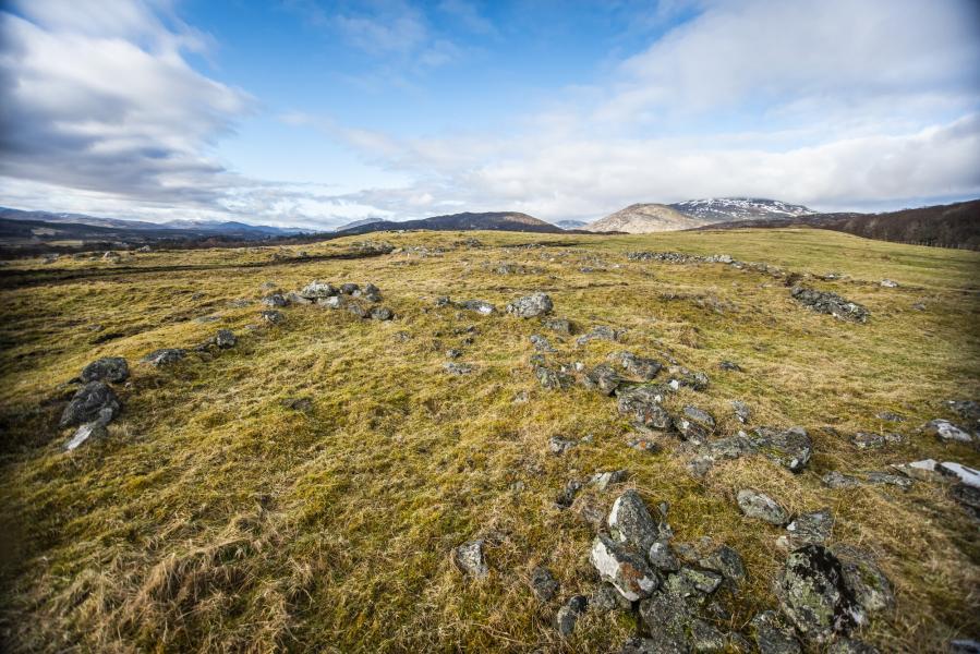
Dun da Lamh Hillfort is just one early Pictish fort in the area. Located on a rocky hilltop near Black Craig, Laggan, it uses the landscape to its advantage; the 4,000 square metres of rocky shelves and terraces built between two vertical crags offered the Picts a strategic position for scoping out enemy groups. While roaming around the National Park today may be more relaxing, standing atop the fort will still give you the same awe-inspiring views over Glen Shira, the River Spey, and beyond.
These ancient communities have also left signs of deep cultural systems. Pictish art – typically in the form of spirals, animals and abstract symbols – suggests evidence of creative expression, even during uncertain times.
Near Ballindalloch is Inveravon Parish Church, home to the Inveravon Pictish Stones, some of which were used as the early foundations for the original church. These curious carvings, which include an eagle and a mirror case, have kept academics and the wider community intrigued about their original significance for centuries. One of Scotland’s most beautiful Pictish crosses, carved over 1,000 years ago, overlooks Loch Kinord near Ballater.
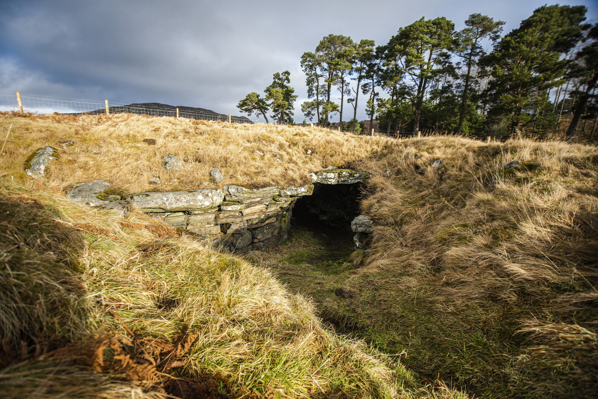
Further west near Kingussie is Lynchat Souterrain, also known as Raitts Cave, a U-shaped underground tunnel / earthhouse which dates back to the late Iron Age (100-400AD). Given its large size and well-preserved state, it’s one of the finest examples of such architecture in northern Scotland. Archaeologists think that structures of this type were used for storage, defence or in rituals.
Alert
Related
Languages
Language is the bedrock of the Cairngorms National Park, telling stories of the land and people. Take any place name, and folk stories or facts might be revealed. After English, the main languages are Gaelic, Scots and Doric.
Castles and ruins
The Cairngorms National Park is home to several impressive castles and ancient ruins, from royal Balmoral Castle to military fortresses. Uncover tales of Scottish clans and Jacobite uprisings via these historic sites.
Archaeology in the Cairngorms
Discover more about archaeological sites around the Cairngorms National Park through VisitCairngorms.
Relevant alerts
-
There is an ongoing wildfire situation at Glenmore within the Cairngorms National Park. Click here for all the latest. We would encourage members of the public to follow current guidance and be aware that the situation may change.
Due to the this wildfire incident, the following paths and routes are closed:
- All the paths around Loch Morlich, Glenmore and Badaguish are closed.
- The Ryvoan pass is closed, this includes all access to the Green Lochan (Lochan Uaine).
- Routes providing access to Cairngorm Mountain, the Northern Corries, Meall A’Bhuachaille, Strath Nethy and Bynack more should be avoided.
- The Abernethy Forest area to the south of Forest Lodge and towards Ryvoan bothy is closed.