Dalwhinnie
Dail Chuinnidh
Alert
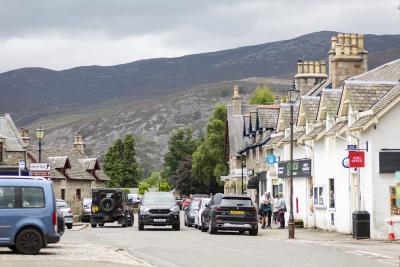
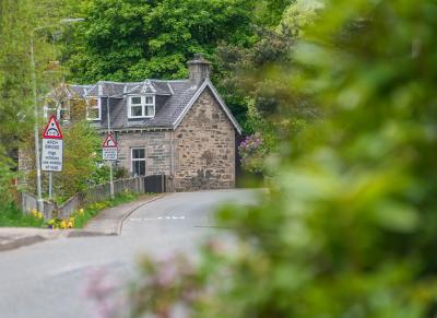
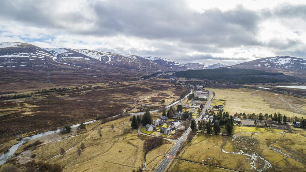
The mountain village of Dalwhinnie is located on the western edge of the Cairngorms National Park at the head of Glen Truim. Striking mountain scenes frame the village in every direction.
In Gaelic, Dalwhinnie translates to ‘meeting place’- a fitting translation for a small yet active community. The name, however, was originally selected to reflect its accessibility. Once a cattle road crossing, Dalwhinnie was the resting point for drovers fueling up before the next, often difficult, stage of their journey: the Pass of Drumochter, a mountain path lying to the south of the village.
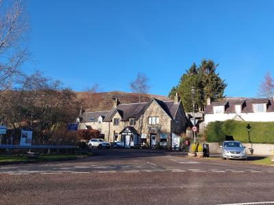
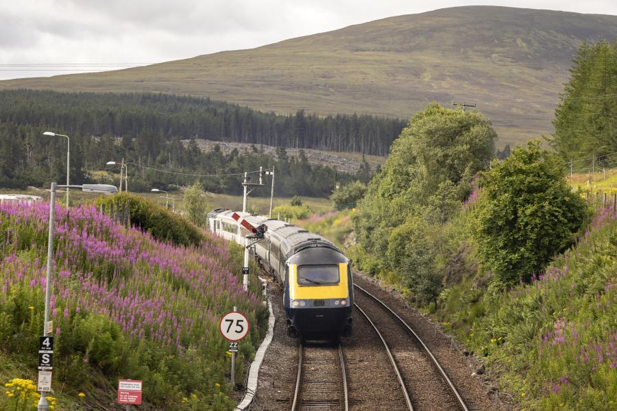
Thankfully, the excellent transport links available today make Dalwhinnie and the surrounding area more reachable. The village sits just off the A9, a major road linking the central regions of Scotland to the Highlands. Dalwhinnie also has its own railway station and is well served by local bus routes.
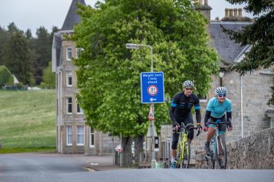
Several cycle routes create options for active travel around Dalwhinnie, helping to lower local emissions. These include the National Cycle Route 7, which links Sunderland to Inverness, and local tracks leading to remote spots such as the nearby Loch Ericht.
From the village, 15 Munros can be accessed by bike or foot. These include Ben Alder (1,148m), Meall Chuaich (951m), and Geal-Chàrn (1,132m).
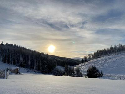
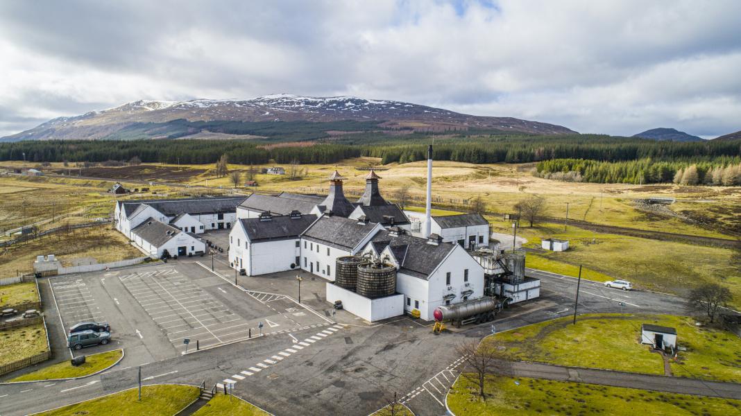
With an elevation of 351m, Dalwhinnie is the highest village in the Highlands. It’s also one of the coldest: a mean annual temperature of 6.6°C makes it popular among mountaineering enthusiasts. Unsurprisingly, Dalwhinnie Distillery, a cornerstone of the community and the single malt whisky industry, is also the UK’s highest distillery.
The mountain village of Dalwhinnie is located on the western edge of the Cairngorms National Park at the head of Glen Truim. Striking mountain scenes frame the village in every direction.
In Gaelic, Dalwhinnie translates to ‘meeting place’- a fitting translation for a small yet active community. The name, however, was originally selected to reflect its accessibility. Once a cattle road crossing, Dalwhinnie was the resting point for drovers fueling up before the next, often difficult, stage of their journey: the Pass of Drumochter, a mountain path lying to the south of the village.
Thankfully, the excellent transport links available today make Dalwhinnie and the surrounding area more reachable. The village sits just off the A9, a major road linking the central regions of Scotland to the Highlands. Dalwhinnie also has its own railway station and is well served by local bus routes.
Several cycle routes create options for active travel around Dalwhinnie, helping to lower local emissions. These include the National Cycle Route 7, which links Sunderland to Inverness, and local tracks leading to remote spots such as the nearby Loch Ericht.
From the village, 15 Munros can be accessed by bike or foot. These include Ben Alder (1,148m), Meall Chuaich (951m), and Geal-Chàrn (1,132m).
With an elevation of 351m, Dalwhinnie is the highest village in the Highlands. It’s also one of the coldest: a mean annual temperature of 6.6°C makes it popular among mountaineering enthusiasts. Unsurprisingly, Dalwhinnie Distillery, a cornerstone of the community and the single malt whisky industry, is also the UK’s highest distillery.
Alert
Sources
Dalwhinnie
key
facts

Location
Learn more about Dalwhinnie
Find out more information for community members and visitors alike.
Relevant alerts
-
There is an ongoing wildfire situation at Glenmore within the Cairngorms National Park. Click here for all the latest. We would encourage members of the public to follow current guidance and be aware that the situation may change.
-
Very high fire risk - 15 to 20 July
The Scottish Fire and Rescue Service has issued a very high wildfire warning impacting areas of the National Park on Wednesday 15 until Monday 20 July. If you are out and about in the Cairngorms National Park please observe the following guidance:
- Do not light any fire or barbecue, in line with the new fire byelaw
- Always ensure cigarettes are fully extinguished and take your litter (including glass) away with you
- Enjoy the outdoors responsibly - most wildfires are caused by human activity
- Stay alert - with dry vegetation and warm weather, fires can start easily, spread rapidly, and burn intensely
- If you see a wildfire, dial 999
For further updates on wildfire risk across Scotland, visit the Scottish Fire and Rescue Service website. To find out more about the fire byelaw, and to see your questions answered, visit our fire byelaw page here.
-
The railway level crossing at Dalwhinnie – at the walkers car park NN 633 846 – has been closed by Network Rail. An alternative point to cross the railway is via the underpass to the south at the Ben Alder cottages (NN 634 841). More information.
- Dalwhinnie waymarked walks:
- the Loch Ericht Walk loop is no longer possible due to the level crossing closure
- to reach the start of the Forest Walk and Coachan Wood Viewpoint the above diversion to the railway underpass is required
- Dalwhinnie waymarked walks: