Newtonmore
Baile Ùr an t-Slèibh

Alert
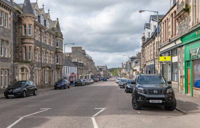
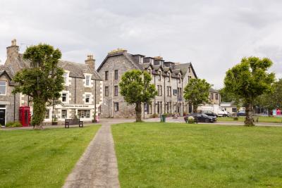
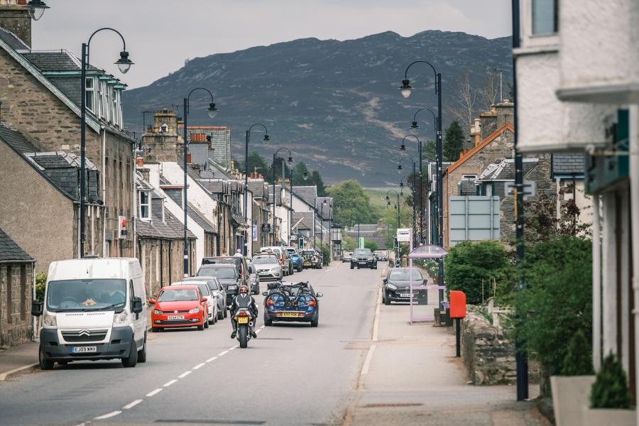
Newtonmore is a traditional village with a history shaped by its location.
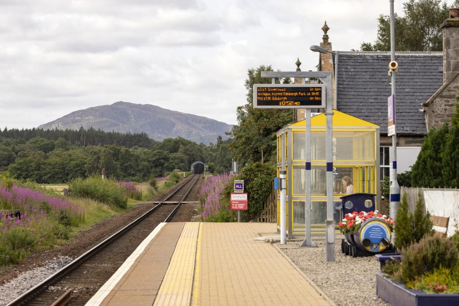
In the 19th century, it was the meeting place of drovers coming from Perth, Fort William and Inverness. It also sits on the main north-south railway line, which has brought holidaymakers to the fresh air and clear waters of the Highlands for over 150 years.
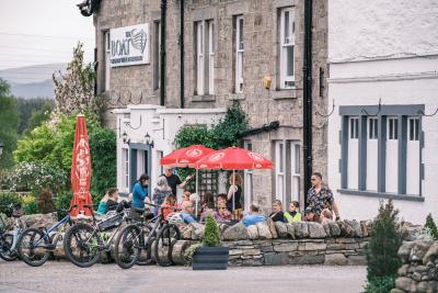
Newtonmore has grown in response to these industries - commerce and tourism - and remains an entrepreneurial place today with high levels of self-employment and an active community.
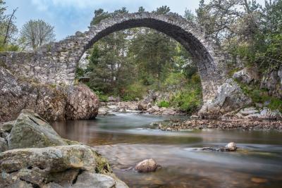
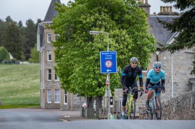
In addition to its excellent transport links, Newtonmore is the southern terminus of the Speyside Way and a stop on the East Highland Way. It offers endless other walking and cycling opportunities too.
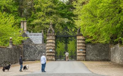
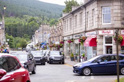
While it has plenty to offer those passing through, Newtonmore is a very livable place thanks to a selection of cafes, restaurants and shops, plus a petrol station. These businesses are complemented by several community-managed assets, including a village hall, playpark, tennis courts, gardens and a bowling club. The region’s heritage is kept alive at the Highland Folk Museum, Clan Macpherson Museum and the Gaelic-language primary school.
Shinty is a big part of local culture: the village’s record-breaking shinty team has been training at their grounds, The Eilean, since 1877. More gentle sporting pursuits - including golf and fishing - are also popular.
The Monadliath mountains to the west and Cairngorms to the east mean the area surrounding Newtonmore is a wildlife haven. A recent project to release Scottish wildcats into the wild means there’s a good chance they’re roaming around the hills, moorlands, and woodlands surrounding the town. Scottish wildcats are elusive animals, however, so it’s much easier to try and spot the 130+ painted models dotted along Newtonmore’s 10km Wildcat Trail.
Newtonmore is linked to Aviemore (16 miles), Inverness (45 miles) and Perth (67 miles) by road, rail and cycle routes.
Newtonmore is a traditional village with a history shaped by its location.
In the 19th century, it was the meeting place of drovers coming from Perth, Fort William and Inverness. It also sits on the main north-south railway line, which has brought holidaymakers to the fresh air and clear waters of the Highlands for over 150 years.
Newtonmore has grown in response to these industries - commerce and tourism - and remains an entrepreneurial place today with high levels of self-employment and an active community.
In addition to its excellent transport links, Newtonmore is the southern terminus of the Speyside Way and a stop on the East Highland Way. It offers endless other walking and cycling opportunities too.
While it has plenty to offer those passing through, Newtonmore is a very livable place thanks to a selection of cafes, restaurants and shops, plus a petrol station. These businesses are complemented by several community-managed assets, including a village hall, playpark, tennis courts, gardens and a bowling club. The region’s heritage is kept alive at the Highland Folk Museum, Clan Macpherson Museum and the Gaelic-language primary school.
Shinty is a big part of local culture: the village’s record-breaking shinty team has been training at their grounds, The Eilean, since 1877. More gentle sporting pursuits - including golf and fishing - are also popular.
The Monadliath mountains to the west and Cairngorms to the east mean the area surrounding Newtonmore is a wildlife haven. A recent project to release Scottish wildcats into the wild means there’s a good chance they’re roaming around the hills, moorlands, and woodlands surrounding the town. Scottish wildcats are elusive animals, however, so it’s much easier to try and spot the 130+ painted models dotted along Newtonmore’s 10km Wildcat Trail.
Newtonmore is linked to Aviemore (16 miles), Inverness (45 miles) and Perth (67 miles) by road, rail and cycle routes.
Alert
Newtonmore
key
facts

Location
Find out more about Newtonmore
Delve into the community’s website for more about visiting Newtonmore and the surrounding area.
Relevant alerts
-
There is an ongoing wildfire situation at Glenmore within the Cairngorms National Park. Click here for all the latest. We would encourage members of the public to follow current guidance and be aware that the situation may change.
-
Very high fire risk - 15 to 20 July
The Scottish Fire and Rescue Service has issued a very high wildfire warning impacting areas of the National Park on Wednesday 15 until Monday 20 July. If you are out and about in the Cairngorms National Park please observe the following guidance:
- Do not light any fire or barbecue, in line with the new fire byelaw
- Always ensure cigarettes are fully extinguished and take your litter (including glass) away with you
- Enjoy the outdoors responsibly - most wildfires are caused by human activity
- Stay alert - with dry vegetation and warm weather, fires can start easily, spread rapidly, and burn intensely
- If you see a wildfire, dial 999
For further updates on wildfire risk across Scotland, visit the Scottish Fire and Rescue Service website. To find out more about the fire byelaw, and to see your questions answered, visit our fire byelaw page here.