
River Spey beaver report 2025
River Spey Beaver Survey Report 2025
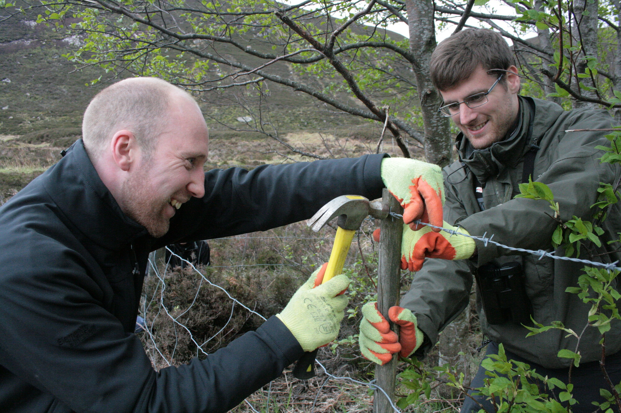
 Jonathan Willet inspecting an Aspen, near Inverton, Kingussie Spirit of the Spey / Dave Craig
River Spey Beaver Survey Report 2025
Prepared by: Jonathan Willet, Beaver Project Manager 8 September 2025
Contents
- Executive summary……………………………………………………………………………3
- The survey………………………………………………………………………………………..4 2.1 Introduction…………………………………………………………………………………4 2.2 Survey methodology………………………………………………………………………4
- Results……………………………………………………………………………………………9 3.1 Day 1: Loch Morlich and Loch Alvie, 30 July…………………………………….9 3.2 Day 2: Kingussie to Dalfaber (Aviemore), 26 August………………………….9 3.3 Day 3: Dalfaber to Old Spey Bridge (Grantown-on-Spey), 28 August..10 3.4 Day 4: Old Spey Bridge (Grantown-on-Spey) to Advie Bridge, 29 August…11 3.5 Day 5: Eilean Dubh (nr. Spey Dam NN5985293896) to Lochan Uvie, 30 August….11 3.6 Day 6: Lochan Uvie to Kingussie, 31 August…………………………………12
- Discussion……………………………………………………………………………………..13 4.1 Location of the beavers……………………………………………………………….13 4.2 Beaver canoes / willow fragments…………………………………………………17 4.3 Tree choice………………………………………………………………………………..18 4.4 Riparian and in-river habitat along the Spey……………………………………18 4.5 Timing of the survey……………………………………………………………………18 4.6 Future population expansion…………………………………………………………19
- Conclusion……………………………………………………………………………………..21
- Appendix 1……………………………………………………………………………………..22
- Appendix 2……………………………………………………………………………………..23
1. Executive summary
The results of the survey are much as we would have expected, with the dispersing beavers feeding in and possibly forming new territories in the areas of the highest quality beaver habitat.
The River Spey was surveyed between Spey Dam and Advie Bridge over five days from 26 to 31 August 2025. Loch Morlich was also surveyed on 30 July. During the survey, four beaver territories were identified, with either lodges or burrows being found or having been previously recorded. To date, we have identified nine territories, all formed by released individuals.
Three locations of recent, concentrated feeding activity were found: at Laggan Bridge, at the confluence of the Tromie, and between the confluence of the Spey and Allt na Criche (Lynwilg) and Dalfaber. No burrow or lodges were found there at the time of the survey; however, these could develop into territories over time. Footage from the RSPB trail cameras on the Tromie seem to have identified two individuals in that area. In the large area of feeding activity between Allt na Criche and Dalfaber, it is likely more than one territory could develop.
In comparison with the survey in May last year, there was a great deal more activity recorded. This was expected, due to both released beavers settling on the river and also dispersal of sexually mature beavers from their family groups.
There are areas of feeding signs, of varying densities, all the way along the river from Spey Dam to Grantown-on-Spey. However, there are some long stretches with little or no feeding signs due to the lack of woody forage. These sections are Gaskbeg to Lochan Uvie, the Truim to Newtonmore Golf Club and Dalfaber to Advie Bridge. 80% of the feeding signs (n=85) recorded along the river were on willows.
To determine if new territories are being established, monthly monitoring of sites will take place in Laggan, Glen Tromie and the Aviemore area.
2. The survey
2.1 Introduction
The survey was undertaken by Park Authority staff from the beaver team. Use of canoes provided the best opportunity to access the riverbank and detect feeding signs and beaver activity. Due to the very low water levels on the Spey, the survey was postponed twice from May 2025. The decision was made to start from Kingussie in the hope that more rain would fall and increase the water levels in the shallow sections of the upper Spey.
2.2 Survey methodology
During this and previous surveys, the predominant tree species being fed on by beavers in or beside the river were willows of various species. The survey consisted of paddling down the Spey looking at the willows on both sides of the river and identifying any visible feeding signs (cut trunks, branches or twigs or bark stripping) of a varying freshness, or coppice regrowth indicating past feeding and so warranting a closer inspection of that particular tree or bush. The feeding signs were recorded using an app on our phones. The point data and associated information was uploaded directly to our GIS server when we got back to a suitable Wi-Fi connection.
The feeding signs were aged in the following way:
- From 2024 / winter 2025 – The cut faces of the wood have silvered up along with the bark, long coppice regrowth indicating a full season of growth from this spring (image 1).
 Image 1 — Old beaver feeding sign and long woody willow coppicing Park Authority / Pete Short
- Summer 2025 – The cut faces of the wood are not silvered up but are dulling, the cut bark is brown. The regrowth is short, indicating that it has only been growing for part of the summer. Material from the tree or bush in question is nearby and has leaves still on it, showing it was cut during this growing season (image 2).
 Image 2 — Semi recent (ie last few months) beaver feeding sign and short, fresh coppicing and browned cut wood © Park Authority / Pete Short
- In the last week – The cut wood is still bright; the bark is fully or partially green, no re-growth below the cut (image 3).
Beaver-cut branches were not recorded as feeding signs, as they could have been washed down the river from a number of locations upstream.
 Image 3 — Very recent (ie last week) beaver bark gnawing, with fleshy white wood and no coppicing at the base of the tree © Park Authority / Pete Short
 Image 4 — Typical beaver feeding sign on willow, growing on the banks of the Spey, often into the water. 80% of all the feeding on trees species in the upper Spey catchment has been on willows. Park Authority / Jonathan Willet
 Image 5 — Bark gnawing on a silver birch tree © Park Authority / Jonathan Willet
3. Results
3.1 Day 1: Loch Morlich and Loch Alvie, 30 July from 10am to 5pm
The shoreline of the loch was paddled round, starting at the outflow of the loch into the River Luineag. The first obvious signs was a 20cm diameter rowan tree that was halfway to being felled; this was almost halfway along the far shore of the loch. It was 50m away from some wild campers, who had not heard anything of the beaver’s activity. The signs of feeding activity increased as we got closer to the release site at Fisherman’s / Beaver Bay.
The inflow to Loch Morlich, the Abhainn Ruigh-eunachan, has been used by the beavers since release, and fresh and older feeding signs were found there. It is likely that the beavers have dug a burrow there. Beaver feeding signs have been found as far up as the footbridge near Glenmore Lodge, although it is likely the beavers have explored further upstream than this.
On the shore nearest the road, a great number of freshly felled willow branches were seen in shallow water over a distance of 200m east of the Sailing Club. The willow had been felled on land and dragged into the water. There were some other old feeding signs seen on willows close to the car parks towards the River Luineag.
In the afternoon Loch Alvie was paddled round, with scattered beaver feeding activity on willows, rowan and some aspen found. No lodge or burrow was seen. The area of greatest feeding activity was on the Allt Dibheach, the outflow of Loch Alvie: this is the main feeding area of the beavers on the Kinrara Estate (WildLand Limited).
3.2 Day 2: Kingussie to Dalfaber (Aviemore), 26 August from 11am to 8.30pm
Feeding signs were found almost as soon as we had put in the water. Abundant old feedings signs were found by the island at Kingussie Grazings, but no activity was seen at the water’s edge by the bank of the old tip. No river erosion was seen there either. The site’s owner sent a photo on 2 September of recent beaver feeding signs on a small willow, close to the A9 bridge.
Old feeding signs were found on a small number of willows growing on the riverbank down to the Tromie. At the confluence with the Spey fresh feeding signs were found.
There was lots of recent activity seen from Lub Mhairi (NH8125103444) down to the confluence with Loch Insh. This is a known territory.
More activity was found at the southern end of Loch Insh and towards the confluence with River Feshie. This is a known territory.
From the Feshie to Inshriach there were almost no beaver feeding signs. The character of the Spey changes, with a huge volume of cobbles and shingle being washed down by the Feshie. This section is Alder dominated, the least palatable native broadleaf for herbivores.
More frequent feeding signs started to be seen at Inshriach and ended just inside the march with Rothiemurchus at the SEPA gauging station. This area is a known territory.
The next beaver feeding signs were found at Allt na Criche (Lynwilg), on a willow dominated island. From here all the way to Dalfaber there were frequent feedings signs. This area has some of the best riparian habitat for beavers in the upper Spey catchment and the concentration of feedings signs are a testament to that. This confirms the assertion on page 51 of the initial assessment of the potential for Eurasian beavers to naturally colonise the National Park, which states: “The River Spey on the whole would offer highly suitable habitat for beaver release and supporting multiple families in its current state… Carrying capacity on the River Spey in its current state is estimated to be high.”
A single beaver was briefly seen in the river close to the Boat of Rothiemurchus, upstream of the B970 bridge.
This was the longest day as there were so many beaver feeding signs to record (50+).
3.3 Day 3: Dalfaber to Old Spey Bridge (Grantown-on-Spey), 28 August from 9.30am to 6pm
After Dalfaber there were practically no beaver feeding signs, although there was suitable habitat (not as high quality as around Aviemore). Only three feeding signs were
found between Dalfaber and the Cairn Distillery. Overall, this survey area had low quality habitat for beavers, except the area around Boat of Garten beyond the Cairn Distillery, down to the Old Spey Bridge and the Spey’s tributaries.
3.4 Day 4: Old Spey Bridge (Grantown-on-Spey) to Advie Bridge, 29 August from 9.30am to 3.30pm
No beaver signs were recorded. The riverbanks tend to be dominated by alder, with few willow trees or bushes, and the river drops a great deal more than in previous stretches, meaning it has a faster flow. It is of medium quality in terms of beaver habitat. The tributaries of the Spey, in this area and in general, have the highest quality beaver habitat. A beaver was recorded on the Castle Grant Beat No. 3 in June, but it does not appear to have become resident in the area.
3.5 Day 5: Eilean Dubh (nr. Spey Dam NN5985293896) to Lochan Uvie, 30 August from 10am to 6pm
Close to where the canoes put in, we found some old feeding signs, probably from winter this year, when fresh beaver signs were found on a larch just below Spey Dam.
At Laggan Bridge, feedings signs had previously been recorded in April 2024 and winter 2025. The latter visit left more feeding signs so presumably was a longer visit, but probably less than a week. Fresh feeding signs were visible from the water and trails leading onto land were seen. These feeding signs continued until the start of the fields at Gaskbeg Farm, where the dense riparian woodland stops.
After the canoe survey had finished, the site around the backwater between the church and the Spey at Laggan Bridge was inspected on foot and a large number of feeding signs and trails leading from the water to trees or vegetation were found.
Between Gaskbeg and the confluence of the Allt Dobhrain at Clunie Castle, only two feeding signs were recorded. There were several willows at the latter site here and they had some fresh feeding signs on them.
There were no more feeding signs recorded until the area between Lochan Uvie and the confluence with the Truim.
3.6 Day 6: Lochan Uvie to Kingussie, 31 August from 10am to 4pm
From the confluence of the Truim down to Inverton (opposite Pitmain Farm), there were no beaver signs recorded. Beyond this point there were more feeding signs; this correlated with the greater area of palatable riparian woodland from Inverton downstream.
4. Discussion
4.1 Location of the beavers
Identifying where beavers are holding territories annually is a key part of the reporting requirements stipulated in our licence to release beavers in the upper Spey catchment. It is also key information to ensure that we can deliver the actions in the Monitoring and Mitigation Plan, particularly around the high-impact sites identified in that document.
Knowing where non-territorial beavers have been also helps us understand the spread of the population over time. This annual survey and all the other more frequent land-based monitoring the beaver team do, mean we have a good understanding of where the beavers are active, allowing us to keep landowners and managers up to date with the beaver activity on their land. It also means that our monthly and annual reports are as detailed and up to date as possible.
By disseminating as much relevant information as possible, we hope to encourage people outwith the beaver team to feedback beaver activity information on an ongoing basis. This will give us as complete a picture as possible of what the beavers are up to and where within the National Park.
The distribution of the beaver feeding activity we found on this survey was directly correlated to the areas of high-quality riparian habitat, identified in the Beaver Trust / Exeter University initial assessment of the potential for Eurasian beavers to naturally colonise the National Park.
Beaver activity at Laggan does seem like an outlier, but it is not uncommon for a single beaver to travel long distances when seeking out a new territory. This long-distance movement has also happened from Aviemore to Fochabers / Garmouth in March 2025. Beaver(s) have already visited Laggan in March / April 2024 and January-March 2025. The areas around Laggan Bridge and Fochabers/Garmouth do have a large area of high-quality beaver habitat.
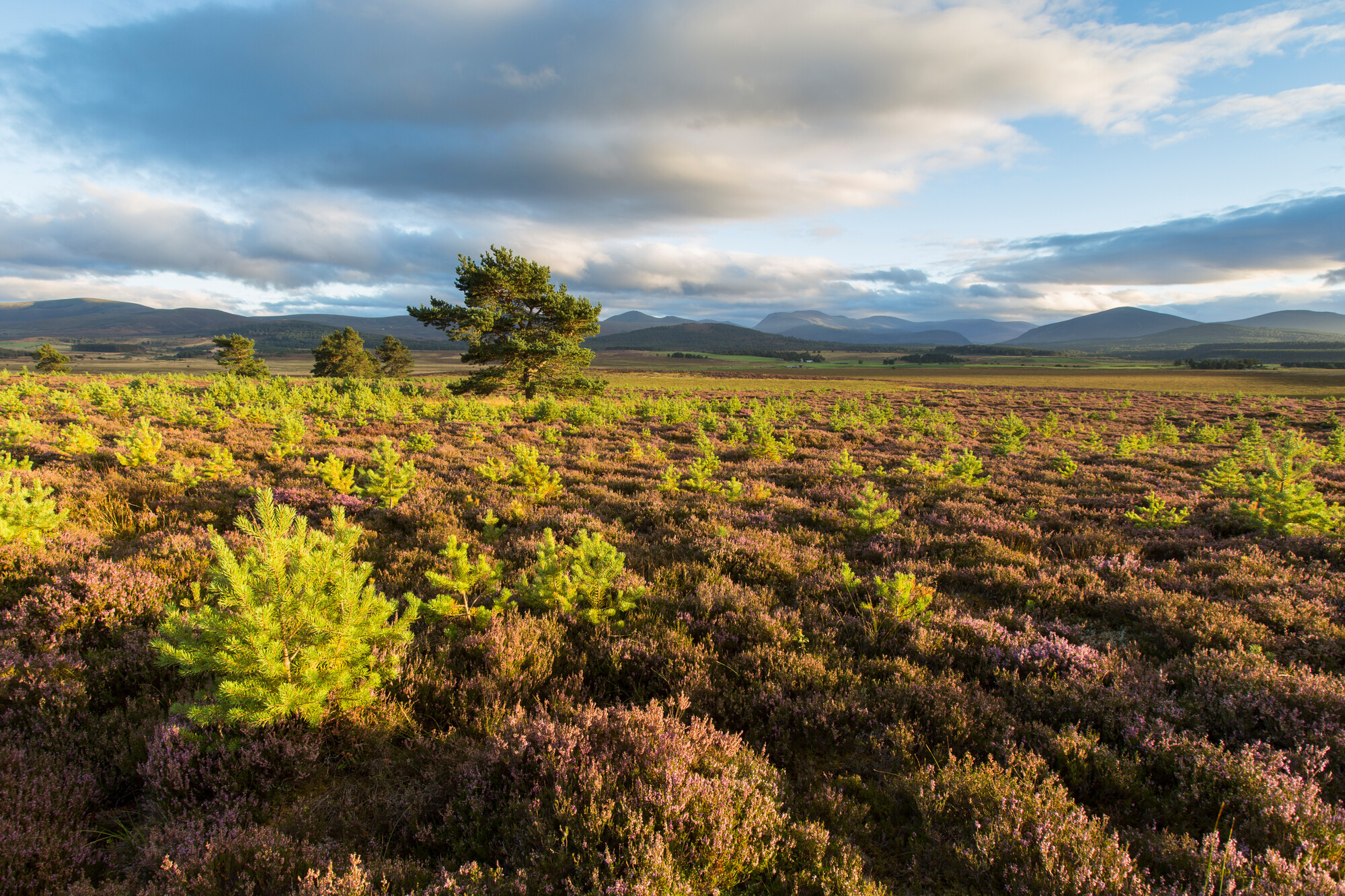
 Image 6 — High quality beaver habitat, Loch Alvie © Spirit of the Spey / Dave Craig
The areas with significant lengths of flood embankment have the poorest riparian habitat, with few or no trees (see image 7). The relative lack of beaver feeding signs recorded there highlight this.
 Image 7 — Low quality beaver habitat near Clunie Castle © Spirit of the Spey / Dave Craig
The 2025 survey shows that there are concentrations of feeding signs in areas where there are no known territories. It is not possible to predict the exact movements of an individual animal but, of all the sites surveyed without established territories, it seems likely that one or more territories will form between the Allt na Criche and Dalfaber in the near future. The high impact sites that we have identified in this area are the outflow to the water treatment works, the Butcher’s Burn that it discharges into and the fishery ponds at Rothiemurchus, beside the confluence of the Spey and Druie.
These sites will be monitored regularly by the beaver team. The proximity of these sites to many recreational users, and / or the fact that they are staffed sites, means that the beaver team are likely be informed if beavers start to have an adverse impact on these sites and any mitigation required can be swiftly implemented, following the protocol in the Monitoring and Mitigation Plan.
Due to the concentration of fresh feeding signs at Laggan Bridge, it seems likely a territory will form there, too. Likewise at the confluence of the Tromie. For these sites, further survey is required to see if territories do establish, what activity is taking place on site and where and if there is one or a pair of beavers holding territory in these locations.
In Laggan there is an area of flood embankment close to the bridge where the beaver(s) are active. If beaver(s) remain in the area, we will intensify our monitoring efforts to find out where their burrow or lodge is. Downstream of the high-quality habitat at Laggan Bridge there is riverbank for a few kilometres until floodbanks are encountered.
Between the Allt na Criche and Dalfaber in the main stem of the river, there appear to be few areas of impact. The Aviemore Holiday Park by the B970 has a flood embankment but this appears to have some rock armouring at its base, which would discourage beaver burrowing. The fish farm close to the confluence of the Druie could potentially be colonised and a lodge built there.
If the beavers burrowed and created a new outflow this would affect the water levels and allow the fish to escape from the ponds. However, if that happened the beavers would react and block the tunnel up, since they would have chosen the site for its deeper water. As with Laggan, if the beaver(s) remain in the area we will intensify our monitoring efforts to find out where the territories and burrows or lodges are.
The survey has been limited to the main stem of the Spey due to the time it takes to undertake a detailed survey, so the tributary burns and rivers have not been surveyed. In the areas of poor beaver habitat – such as Gaskbeg to Lochan Uvie, the Truim to Newtonmore Golf Club and Dalfaber Boat of Garten, Boat of Garten to the Cairn Distillery — there are tributaries with high quality beaver habitat and a low gradient, which we would expect to be colonised as the beaver population expands.
The speed of colonisation is very hard to predict, but considering the Scottish population of beavers is increasing at 30% per annum, large-scale colonisation of these areas is likely in five to 10 years, with some isolated territories forming in these areas sooner.
Up to 30% of a beaver population can characterised as non-territorial, ‘floating’ animals that move over a wide area. This means, with an increasing population in the area, a single beaver holding a territory in suitable habitat will likely not stay single very long.
4.2 Beaver canoes / willow fragments
The feeding behaviour of beavers is often haphazard. On the survey we found whole pieces of unstripped willow branch in the water, the very large branches often being called ‘beaver canoes’ as they float in the water. The sections that were a few months old had sprouted roots and were washing up on the riverbanks.
This ‘beaching’ of willow fragments will start to increase the number of willows establishing downstream of the feeding areas. In time this could have a dramatic effect on areas that are almost treeless and have a low grazing pressure. By having a head start in terms of size, they may be able to establish more successful than by seed.
Some willow species, particularly crack willow, spread by fragments of the tree naturally breaking off and establishing further downstream. Beavers are accelerating this process for all the willow species in the area.
 Image 8 — Sprouting (left of image) and rooting (right of image) beaver-chewed willow branch in the River Spey Park Authority / Pete Short
4.3 Tree choice
Willows are by far and away the most fed-on tree that we found on this survey: willow 80%, birch 9.4%, aspen 4.7%, rowan 3.5%, and alder and Scots pine 1% (n=85). Alder is the least palatable broadleaf (see appendix 1) and we did not see any feeding signs on these trees.
On loch and wetland releases sites away from the Spey, we do see a preference for willow, but also aspen, birch and rowan as the main species being felled and fed on, depending on their relative abundance.
4.4 Riparian and in-river habitat along the Spey
Alder woodland dominates downstream from the confluence of the Truim, Calder and Feshie. This is possibly due to the massive amount of river shingle / cobbles washed down these rivers into the Spey, constantly creating new habitat for trees to colonise. When only alder establishes it shows the grazing pressure is fairly high, allowing some broadleaved tree regeneration but inhibiting the establishment of more palatable broadleaved species. Alder scores the lowest of all broadleaved trees for palatability to herbivores (see appendix 1).
On the shingle islands that are relatively inaccessible to grazing animals, we found a huge amount of willow growth, dominating the tree species composition. There are a few large islands in the Spey, particularly downstream from Aviemore. These islands are above all but the highest floods and it is likely that beavers will build burrows or lodges there. We have already seen this happen on one small island.
4.5 Timing of the survey
Last year the survey took place in May. This year’s survey was also planned to take place in that month; however, the water levels were too low to allow a comprehensive canoe survey. The survey finally took place in August after another postponement.
As the day length shortens in late August, beavers have an urge to start creating a food cache (see the areas of twigs poking out of the water at the top of image 9). This urge to hoard food leads to an increased felling of woody forage. The food cache in image 9 is around three meters square and one metre deep and dates from late winter. It would
have been larger earlier in the winter, but now only the twigs of the branches are visible above the water. The cache is created close to the entrance to the lodge or burrow. The branches are left underwater until required, with the cold water keeping the bark on the branches fresh.
As the feedings signs are most frequent and obvious at this time of year, we will undertake the 2026 beaver survey in September to see if signs of beaver activity are more frequent and / or obvious. Looking at the activity, we have recorded over the whole of this survey we have a high level of confidence that we have not missed any sites where beavers have been feeding for a period of weeks. This means the change in timing of the survey is unlikely to make a difference to the number of territories (or potential territories) recorded. As territories start to be held in autumn, we are more likely to find the new lodges and burrows in these territories whilst under construction.
 Image 9 — Food cache at Lochan Mor, Rothiemurchus, 27 March 2025 © Park Authority / Jonathan Willet
4.6 Future population expansion
Over the next five years, we would expect to see a steady continuation of territory formation in the best quality habitat, with perhaps some of the tributaries of the Spey
being colonised. This colonisation will likely be at a high density in the core Kingussie to Aviemore area (due to the abundance of high quality habitat and sexually mature, non-territorial beavers) and at lower densities in the areas up and downstream of this area where there is less high quality habitat.
5. Conclusion
The results of the survey are much as we would have expected, with the dispersing beavers feeding in and possibly forming new territories in the areas of the highest quality beaver habitat.
Willow was by far and away the main tree species being fed on and its abundance in riparian woodland is a very good indicator of high-quality beaver habitat.
Two or more additional territories could be formed this autumn. This is what we would expect to see happening when there are dispersing beavers of both sexes, in areas of high quality habitat (without existing beavers in those locations).
The survey will be repeated in September next year to maximise the visibility of feeding signs on woody forage.
6. Appendix 1
Relative palatability of native tree species to browsing. Palatability is the innate attractiveness of the species to being browsed and is likely to be a function of digestibility and toxicity.
| Palatability | Tree species |
|---|---|
| 1 | Aspen, ash, elder, willow |
| 2 | Elm, hazel, holly, oak, rowan |
| 3 | Blackthorn, Douglas fir, gean, hawthorn, larches, sycamore |
| 4 | Birch, beech, lodgepole pine, Scots pine |
| 5 | Bird cherry, juniper, Norway spruce, western hemlock |
| 6 | Alder, rhododendron, Sitka spruce |
Source: Scottish Forestry
7. Appendix 2

Legend: *