
Item 5 report
Committee report
Development proposed:
Erection of warehouse building (class 6), formation of access track, parking area, and associated works at Land 130 Metres South East Of House Of Bruar, Pitagowan Blair Atholl, Pitlochry PH18 5TW
Reference: 2023/0406/DET Applicant: The House of Bruar Ltd Date called-in: 30 October 2023 Recommendation: Refuse Case officer: Katie Crerar, Planning Officer
Crown copyright and database rights 2025. Ordnance Survey AC0000821810. The representation of features or boundaries in which Cairngorms National Park or others have an interest does not necessarily imply their true positions. For further information please contact the appropriate authority.
This map has been produced to aid in the statutory process of dealing with planning applications. The map is to help identify the site and its surroundings and to aid Planning Officers, Committee Members and the Public in the determination of the proposal. Maps shown in the Planning Committee Report can only be used for the purposes of the Planning Committee. Any other use risks infringing Crown Copyright and may lead to prosecution or civil proceedings. Maps produced within this Planning Committee Report can only be reproduced with the express permission of the Cairngorms National Park Authority and other Copyright holders. This permission must be granted in advance.
Site description, proposal and history
Site description
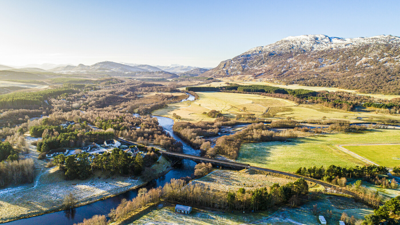
- This application relates to the well-known House of Bruar retail complex which is situated to the immediate north of the A9 and east of the hamlet of Pitagowan.
- The application site lies approximately 350 meters (m) east of the main House of Bruar complex. It is situated at the junction of and between the River Garry running along the eastern side of the site and the smaller Bruar Water along the northern side with the A9 on its south-west boundary.
- The site is primarily grassland which is kept mown at the western side and managed as meadow on the east side. Much of the site is relatively level and low-lying, sitting 5m below the A9 with the ground rising to the west towards an area of car parking and the House of Bruar itself.
- There is an existing access to the site from the B8079 which runs along the edge of the existing eastern car park.
Proposal
The drawings and documents associated with this application are listed below and are available on the Cairngorms National Park Authority website unless noted otherwise:
| Title | Drawing number | Date on plan* | Date received |
|---|---|---|---|
| Location Plan | 2310.L01e | 03/01/2023 | 26/10/2023 |
| Site Plan as existing | 2310.L02e | 05/10/2023 | 26/10/2023 |
| Site Plan as existing | 2310.L04d | 05/10/2023 | 26/10/2023 |
| Site Plan as proposed | 2310.L05r | 05⁄10 | 06/02/2025 |
| Site Plan as proposed | 2310.L03m | 05⁄10 | 06/02/2025 |
| Title | Drawing number | Date on plan* | Date received |
|---|---|---|---|
| Floor and Roof Plans | 2310.P07k | 05⁄10 | 06/02/2025 |
| Elevations and Sections as proposed | 2310.P06k | 05⁄10 | 06/02/2025 |
| Landscaping Plan | 2310.L90n | 05⁄10 | 06/02/2025 |
| Planning Statement | N/A | 16/10/2023 | 26/10/2023 |
| Drainage Impact Assessment* | N/A | 01/02/2024 | 09/08/2024 |
| Flood Risk Assessment* | N/A | 01/08/2024 | 09/08/2024 |
| Technical Addendum to Flood Risk Assessment | N/A | 24/01/2025 | 06/02/2025 |
| Planning Statement – Addendum on flood risk* | N/A | 01/02/2025 | 06/02/2025 |
| Preliminary Ecological Appraisal and Ecological Impact Assessment | N/A | 25/08/2023 | 26/10/2023 |
| Freshwater Pearl Mussel Survey Report* | N/A | 01/04/2024 | 28/05/2024 |
| Otter Survey Report | N/A | 12/03/2024 | 28/05/2024 |
| Tree Survey Report – Tree Survey, Arboricultural Impact Assessment and Tree Protection Plan | N/A | 01/03/2024 | 28/05/2024 |
| Arboricultural Impact Plan | N/A | 10/03/2024 | 28/05/2024 |
| Tree Constraints Plan | N/A | 10/03/2024 | 28/05/2024 |
| Tree Protection Plan | N/A | 10/03/2024 | 28/05/2024 |
*Where no specific day of month has been provided on the plan, the system defaults to the first of the month.
- This proposal seeks planning permission for the erection of a warehouse building (Class 6) to support the operations of the House of Bruar retail business along with associated access track, parking area and other associated works.
- This warehouse is being proposed as part of a wider strategic investment plan at the House of Bruar to develop a fabric hall and marketplace focusing on Scottish textiles. A separate planning application was approved by Perth and Kinross Council in August 2024 for the partial change of use of one of the existing warehouses to form additional retail space. The proposed warehouse that is the subject of this application, is therefore intended to offset some of the warehouse
storage space lost as a result of that proposal. It will be used for storage and distribution to support the onsite retail operation as well as including limited space for food storage and preparation.
- The application site was chosen as the closest available location for the business that is accessible for both logistics and staff.
- The proposed warehouse building is rectangular in form, extending to 66.46 metres long by 20.18 metres deep. It has a pitched roof with a ridge height of 10.2 metres. The exterior walls and roof will be finished in Kingspan Plastisol KS1000 coated steel composite panels in bottle green colour (RAL 6007) matching other buildings at the House of Bruar site.
- The warehouse roof will have solar panels (on the southern elevation) and Polycarbonate roof lights along with an extract roof cowal (all painted in the matching bottle green colour).
- There will be ‘House of Bruar’ signage in large scale lettering on the southern elevation along with two vehicle accesses secured by large Plasticol coated roller shutter doors. In addition, the southern elevation will have a Plasticol coated aluminium double-glazed window in matching bottle green (RAL 60007) and a pedestrian door with steps. There will be external lights above all vehicular and pedestrian doors.
- The other elevations of the proposed building all have pedestrian access doors (the ones on the northern and eastern elevations have external steps) and lighting above them. There are also additional lights on these elevations and a number of small vents (See Elevations and Sections as Proposed).
- The western end of the proposed building will house condensers and two Plasticol coated aluminium double-glazed windows in matching bottle green (RAL 6007).
- Access to the building is proposed to be taken from an existing track which is connected directly with the B8079 to the northwest of the site. A new tarmacked access road will be built down to the site and will curve around to the front of the
building (southern elevation) and extend along the length of the front elevation. Ten gravelled car parking spaces and two van spaces will be created at the front of the building adjoining the access road. There will also be tarmacked vehicular access created into the warehouse.
- Two roof water swales will be created to the west and south of the warehouse. There will be landscaping around the warehouse, and a pedestrian path will be created along the western and northern boundary of the building connecting to the access road.
- A bin storage area will be created outside the western end of the building and food and warehouse waste will be transported from here to the House of Bruar’s main collection point for uplifting. There will also be an LPG tank on a plinth and a self-bunded oil tank located adjacent to the bin storage area.
History
- There is no recent history on the application site itself. However, there have been recent applications at the House of Bruar, including: a) 23/01379/FLL — part change of use and alterations to ground floor office / storage space (Classes 4 and 5) to form additional retail space (Class 1A) approved by Perth and Kinross Council. b) 2023/0145/DET — renewal of permission 19/02111/FLL (Erection of art gallery building, reconfigure car park, installation of four air source heat pumps, landscaping and associated works) – Approved by the Park Authority. c) 23/00071/FLL — Extension to warehouse / offices to form additional office space (class 2), product development / food preparation areas with associated storage and distribution (class 6) – Approved by Perth and Kinross Council.
Habitats Regulations Appraisal
- A Habitats Regulations Appraisal (HRA) has been undertaken to consider the potential effects of the development upon the conservation objectives of the Natura sites listed within the HRA document, which is attached as Appendix 2. The Natura site in this case is the River Tay Special Area of Conservation (SAC) which
is designated for its otter, brook lamprey, river lamprey, sea lamprey and Atlantic salmon interests.
- The HRA considers that there are no likely significant effects on clear-water lakes or lochs with aquatic vegetation and poor to moderate nutrient levels. In respect of Atlantic salmon, otter and lamprey species, although there will be no direct loss of any suitable lamprey habitats, there is potential for silt or pollution to enter the River Garry or Bruar Water during the construction process meaning it is likely to have a significant effect.
- However, with the implementation of mitigation set out in a Construction Environmental Method Statement (CEMP) and a Pollution Prevention Plan (secured by condition if planning permission is granted), there will not be an adverse effect on the integrity of the River Tay SAC. The Pollution Prevention Plan must be site specific and include specific reference to preventing any silts, fuels, or other chemicals from entering the nearby watercourses. Ideally the plan will include a plan detailing locations for storing fuel, refuelling machinery, concrete wash out area etc. Other details to be included in the CEMP should include a method statement for construction of the outflow and the species protection plan for otter.
Development plan context
Policies
National policy
| National policy | National Planning Framework 4 (NPF4) Scotland 2045 |
|---|---|
| Policy 1 | Tackling the climate and nature crises |
| Policy 2 | Climate mitigation and adaptation |
| Policy 3 | Biodiversity |
| Policy 4 | Natural places |
| Policy 6 | Forestry, woodland and trees |
| Policy 12 | Zero waste |
| Policy 13 | Sustainable transport |
| Policy 14 | Design, quality and place |
| Policy 20 | Blue and green infrastructure |
| Policy 22 | Flood risk and water management |
| Policy 23 | Health and safety |
| National policy | National Planning Framework 4 (NPF4) Scotland 2045 |
|---|---|
| Policy 26 | Business and industry |
| Policy 29 | Rural development |
Strategic policy
Cairngorms National Park Partnership Plan 2022 – 2027
Local plan policy
Cairngorms National Park Local Development Plan (2021) (Policies relevant to the assessment of this application are marked with a cross (x))
| Local plan policy | ||
|---|---|---|
| Policy 1 | New housing development | |
| Policy 2 | Supporting economic growth | x |
| Policy 3 | Design and placemaking | x |
| Policy 4 | Natural heritage | x |
| Policy 5 | Landscape | x |
| Policy 6 | The siting and design of digital communications equipment | |
| Policy 7 | Renewable energy | |
| Policy 8 | Open space, sport and recreation | |
| Policy 9 | Cultural heritage | |
| Policy 10 | Resources | x |
| Policy 11 | Developer obligations |
- All new development proposals require to be assessed in relation to policies contained in the adopted Development Plan which comprises National Planning Framework 4 (NPF4) and the Cairngorms National Park Local Development Plan 2021. The full wording of policies can be found at: https://www.gov.scot/publications/national-planning-framework‑4/documents/ and at: https://cairngorms.co.uk/wp-content/uploads/2021/03/CNPA-LDP-2021-web.pdf
Planning guidance
- Supplementary guidance also forms part of the Local Development Plan and provides more details about how to comply with the policies. Guidance that is relevant to this application is marked with a cross (x).
| Policy 1 | Housing supplementary guidance | |
|---|---|---|
| Policy 2 | Supporting economic growth non-statutory guidance | x |
| Policy 3 | Design and placemaking non-statutory guidance | x |
| Policy 4 | Natural heritage non-statutory guidance | x |
| Policy 5 | Landscape non-statutory guidance | x |
| Policy 7 | Renewable energy non-statutory guidance | |
| Policy 8 | Open space, sport and recreation non-statutory guidance | |
| Policy 9 | Cultural heritage non-statutory guidance | |
| Policy 10 | Resources non-statutory guidance | x |
| Policy 11 | Developer obligations supplementary guidance |
Consultations
A summary of the main issues raised by consultees now follows:
Scottish Environment Protection Agency (SEPA) was consulted as part of the development lies within an area identified on their flood risk maps. SEPA submitted a holding objection to the proposal in November 2023 due to lack of information in respect of flooding. A Flood Risk Assessment was provided, and SEPA maintained their objection in September 2024 on the basis that most of the site is within the flood risk area and that mitigation would not be suitable in this instance as the development is not an exception under Policy 22a of National Planning Framework 4 (2023). Further to this objection, the applicant reduced the size of the warehouse to bring it completely outwith SEPA’s flood risk area. SEPA were consulted again on the revised proposals in February 2025 and again maintained their objection on the basis that the Flood Risk Assessment undertaken by the applicant clearly showed that most of the proposed warehouse would be at risk of flooding. They noted that SEPA’s maps are based on strategic-scale modelling which does not always give a good representation of flooding at a local scale. They maintained
that as the development is not an exception under Policy 22 of NPF4, no mitigation can be accepted.
Transport Scotland have requested the inclusion of the following conditions to ensure that the access road and associated works are designed and constructed to a standard that is compatible with the requirements of the proposed accommodation track being provided as part of the A9 dualling scheme over which it crossed and overlaps with. a) Prior to the commencement of the development, details of the proposed access alignment and construction specification, generally as illustrated on Hannay McLaren Architects Drawing Nos. 2310.Lo3b and 2310.Lo5j, shall be submitted to, and agreed with the Planning Authority, after consultation with Transport Scotland, and thereafter, and prior to occupation of any part of the development hereby permitted, the proposed access shall be constructed to the agreed details to the satisfaction of the Planning Authority. b) Prior to the commencement of the development, details of the proposed drainage associated with the access road proposals shall be submitted to, and agreed with the Planning Authority, after consultation with Transport Scotland, and thereafter, and prior to occupation of any part of the development hereby permitted, the proposed drainage shall be constructed to the agreed details to the satisfaction of the Planning Authority. Note: There shall be no drainage connections to the trunk road drainage system. c) Prior to the commencement of the development, details of the proposed signage, Non-Motorised User arrangements, plus any stock fencing and gates, associated with the proposed access road proposals (where it overlaps with the access track from the B8079 to the underbridge on the A9 which is part of the A9 Dualling programme), shall be submitted to, and agreed with the Planning Authority, after consultation with Transport Scotland and thereafter, and prior to occupation of any part of the development hereby permitted, the proposed access shall be constructed to the agreed details to the satisfaction of the Planning Authority.
Scottish Water do not object to the application however do not verify if the proposed development can currently be serviced. They confirm that there is capacity at Killiecrankie Water Treatment Works and the nearest public water
main is approximately 470m from the site. They state that there is no public Wastewater infrastructure and advise submitting a Pre-Development Enquiry to enable them to fully appraise the proposal.
- Perth and Kinross Council’s Transportation and Development Team accept the access arrangements acknowledging that the vehicular access to the site is taken off a private access which is, in turn, taken off the B8079 public road and a new vehicle access to / from a public road is not being proposed. They highlight that based on the larger warehouse floor area, a requirement of five cycle parking, 15 vehicle, one power two-wheeler and two disabled parking spaces would be expected but given that the site adjoins the existing car park where additional parking space can be accessed when necessary, a lower provision of vehicle parking may be appropriate.
- They also note that National Cycle Network Route 7 runs along the adjacent B8079 and B847 roads and in accordance with planning policy, the applicant should detail provision of secure cycle parking. They have proposed the following condition:
- ‘Prior to commencement of any development on site, a detailed design for the proposed secure covered cycle parking facility for a minimum of five cycles shall be submitted to and approved in writing by the Planning Authority in consultation with the Roads Authority. The cycle parking, as approved in writing, shall be implemented in accordance with the approved details to the satisfaction of the Council as Planning Authority prior to the development being brought into use.
- Finally, the Transportation and Development Team highlight that the National Roads Development Guide stipulates a minimum bay size for vans of 7.5m x 3.5m to allow for the trend of increasingly long vans. The proposed bays are 7m in length and recommend that the van parking spaces are extended to 7.5m. It is also recommended that the turning space at the gravel area for vans is extended to allow for ease of manoeuvring and egress from the van parking area in a forward-facing gear.
- Perth and Kinross Council’s Flood Team objected to the proposal after the submission of the Flood Risk Assessment on the basis that the Floor Risk Assessment confirms the majority of the site is located within a fluvial flood risk area. In addition, it does not qualify as an exception under Policy 22a of NPF4 and therefore the mitigation measures proposed fail to align with the principle of flood risk avoidance. They maintained their objection following the reduction of the size of the warehouse as it does not minimize the vulnerability of the development to flooding and still does not comply with Policy 22 of NPF4.
- Perth and Kinross Council’s Communities Commercial Waste Team are satisfied that the bin store meets the requirements for the site and do not require any alterations to the proposal.
- Perth and Kinross Council’s Developer Contributions Officer had no comments to make on this proposal and do not require any contributions.
- Cairngorm National Park Authority’s Ecological Advice Officer highlights that the two watercourses bordering the site (River Garry and Bruar Water) are part of the River Tay SAC and there is potential for a large significance of effects as they are sensitive to changes in water quality which may result from pollution events on the site. To address this, a Construction Environmental Management Plan (CEMP) will be required including a Pollution Prevention Plan.
- The Ecology Advice Officer also highlights that the development footprint impacts on the root protection area of four trees and works should be completed in accordance with the Tree Survey, Arboricultural Impact Assessment and Tree Protection Plan. There is also evidence of an otter shelter outwith the site boundary and works should proceed as per the Species Protection Plan ensuring a 30m around the otter resting place.
- The application includes provisions for mitigating and enhancing biodiversity and a biodiversity statement / plan could be provided and agreed prior to works commencing on site.
- Cairngorm National Park Authority’s Landscape Advisor highlights that whilst the lower portion of the building would be largely screened by its position 5m below the surrounding ground levels to the west and the south, there would be some views to the upper part of the building from the A9 (particularly travelling west bound) and the paths close to the Falls of Bruar. However, it is acknowledged that it would be associated with the existing group of buildings and car parks within the wider landscape.
- The Landscape Advisor considers that the scale of the proposal would have an adverse effect on Special Landscape Quality 4: Glens and Straths, however this could largely be mitigated by appropriate tree and scrub planting. Therefore, a revised landscaping plan with increased screen planting (comprising native species and be managed to ensure successful establishment and enhance biodiversity, and to reflect the vegetation beyond the site boundary) and including details of sizes, species, numbers and locations should be provided.
- Details of sensitively designed lighting should be provided which minimises light spill. Landscape management and maintenance proposals should be provided for the new and existing planting and the proposed Sustainable Urban Drainage Systems (SUDS) areas. A Construction Method Statement should also be provided detailing the method of groundworks, soil excavation and storage, and ground and vegetation restoration.
- Blair Atholl and Struan Community Council was consulted but did not submit a response.
Representations
- There were no representations to this application.
Appraisal
- Section 25 of the 1997 Act as amended requires applications to be determined in accordance with the Development Plan. This now comprises the Cairngorms National Park Local Development Plan 2021, and the National Planning Framework 4. Where there is conflict between policies, NPF4 policies will be used.
- The main planning considerations in this case are the principle of development, flood risk, the impact upon landscape, siting and design, ecological impacts and access which are considered in detail below.
Principle of development
- This application relates to the House of Bruar, which is an established and thriving retail business located close to the southern gateway of the National Park and plays an important role in the local economy attracting two million customers a year and employing 350 employees.
- National Planning Framework 4 (NPF4) Policy 29: Rural Development seeks to support development proposals that contribute to the viability, sustainability and diversity of rural communities and the rural economy. The policy explains that proposals in rural areas should be suitably scaled, sited and designed to be in keeping with the character of the area and should consider how they will contribute to local living and take into account the transport needs as appropriate for the rural location.
- In addition, the National Park’s Local Development Plan Policy 2: Supporting Economic Growth, part 2.4 (other economic development) supports proposals that will help to extend the economy and enhance the range and quality of economic opportunities. Proposals should have no adverse environmental or amenity impacts, should be compatible with the existing business activity in the area and support the vitality and viability of the local economy.
- Bruar and Pitagowan is identified as a rural settlement (which has no settlement boundary) within the Local Development Plan, and one of the settlement objectives is to ‘support the strategically important development at the House of Bruar and ensure it benefits the local community’.
- The House of Bruar is a thriving rural business and this proposal forms part of a strategic investment plan to respond to customer and supplier interest in a fabric hall and marketplace for the design, manufacture and sale of Scottish fabrics. According to the application, ‘this investment is designed to ensure that the business remains innovative and relevant’. In addition to this, the warehouse is also
intended to provide business critical resilience to the House of Bruar during the A9 dualling where there will be a need to be able to accommodate greater on-site inventory.
- It is recognised that the House of Bruar makes a significant contribution to the viability and sustainability of the local area and this proposal will support the ongoing operation and expansion of the business. Whilst this proposal is in keeping with the wider functions of the existing business and is generally acceptable as a principle which largely complies with NPF4 Policy 29 and the relevant settlement objective for Bruar and Pitagowan, the potential flood risk implications (set out in the next section) mean that there are potentially adverse environmental implications and therefore the proposal does not accord with all of the relevant provisions of the Cairngorms National Park Local Development Plan Policy 2.
Flood Risk
- NPF4 Policy 22: Flood risk and water management creates a presumption against all development at risk from flooding unless they meet one of four criteria set out in part a) of the policy. These are for: i. Essential infrastructure; ii. Water compatible uses; iii. Redevelopment of an existing building for an equal or less vulnerable use; or iv. Previously used sites in built up areas where the LDP has identified a need to bring these into positive use and where long-term safety and resilience can be secured.
- In addition, Policy 10: Resources of the Cairngorms Local Development Plan 2021 requires (amongst other things) to ensure there is no detrimental impacts on the water environment (10.1), and that all development should be free from Medium to High risk of flooding from all sources taking into account climate change, not increase the risk of flooding elsewhere or affect the ability of the functional floodplain to store or move flood waters (10.2).
- The development site borders both the Bruar Water to the north and the River Garry along the southeast. A larger warehouse was initially submitted which
partially lay within SEPA’s Medium (0.5% chance) and Low (0.1% chance) Likelihood risk of river flooding. In response to SEPA’s objection, the proposal was substantially reduced, taking the building’s footprint outwith the area of SEPA’s identified flood risk. However, the Flood Risk