
Item 5 SlugainBurnRestorationCommitteeReport 20260160DET
Item 5 Planning Committee 9 October 2026
Committee report
Development proposed: Slugain Burn Restoration Project: River channel realignment, habitat restoration, road realignment, revised river crossing and installation of culvert at Land 1.4km SW of Inverlaidnan Station Road – Dalnahaitnach, Carrbridge, Highland
Reference: 2026/0160/DET Applicant: Cairngorms National Park Authority Date called-in: 25 May 2026 Recommendation: Approve subject to conditions Case officer: Katie Crerar, Planning Officer
Item 5 Planning Committee 9 October 2026
(Map image showing the site and surrounding area)
This map has been produced to aid in the statutory process of dealing with planning applications. The map is to help identify the site and its surroundings and to aid Planning Officers, Committee Members and the Public in the determination of the proposal. Maps shown in the Planning Committee Report can only be used for the purposes of the Planning Committee. Any other use risks infringing Crown Copyright and may lead to prosecution or civil proceedings. Maps produced within this Planning Committee Report can only be reproduced with the express permission of the Cairngorms National Park Authority and other Copyright holders. This permission must be granted in advance.
Item 5 Planning Committee 9 October 2026
Site description, proposal and history
Site description
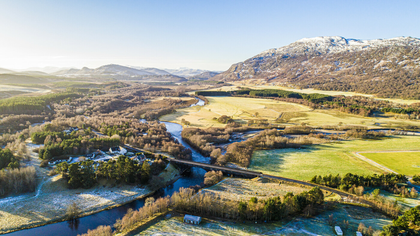
- The development site lies approximately 4 miles southwest of Carrbridge at Dalnahaitnach. The western side of the site comprises approximately 240m of the lower reaches of Slugain Burn – approximately 75 metres upstream (to the south) of an existing low clearance bridge and 165m of straightened embanked channel (to the north) which then follows a more natural meander to its confluence with the River Dulnain (outwith the site).
- The application site also comprises a 100m section of minor road U2239 between Carrbridge and Dalnahaitnach. There is a low clearance bridge at the southwestern end of the application site which connects the road from the east to a small informal car park at Dalnahaitnach.
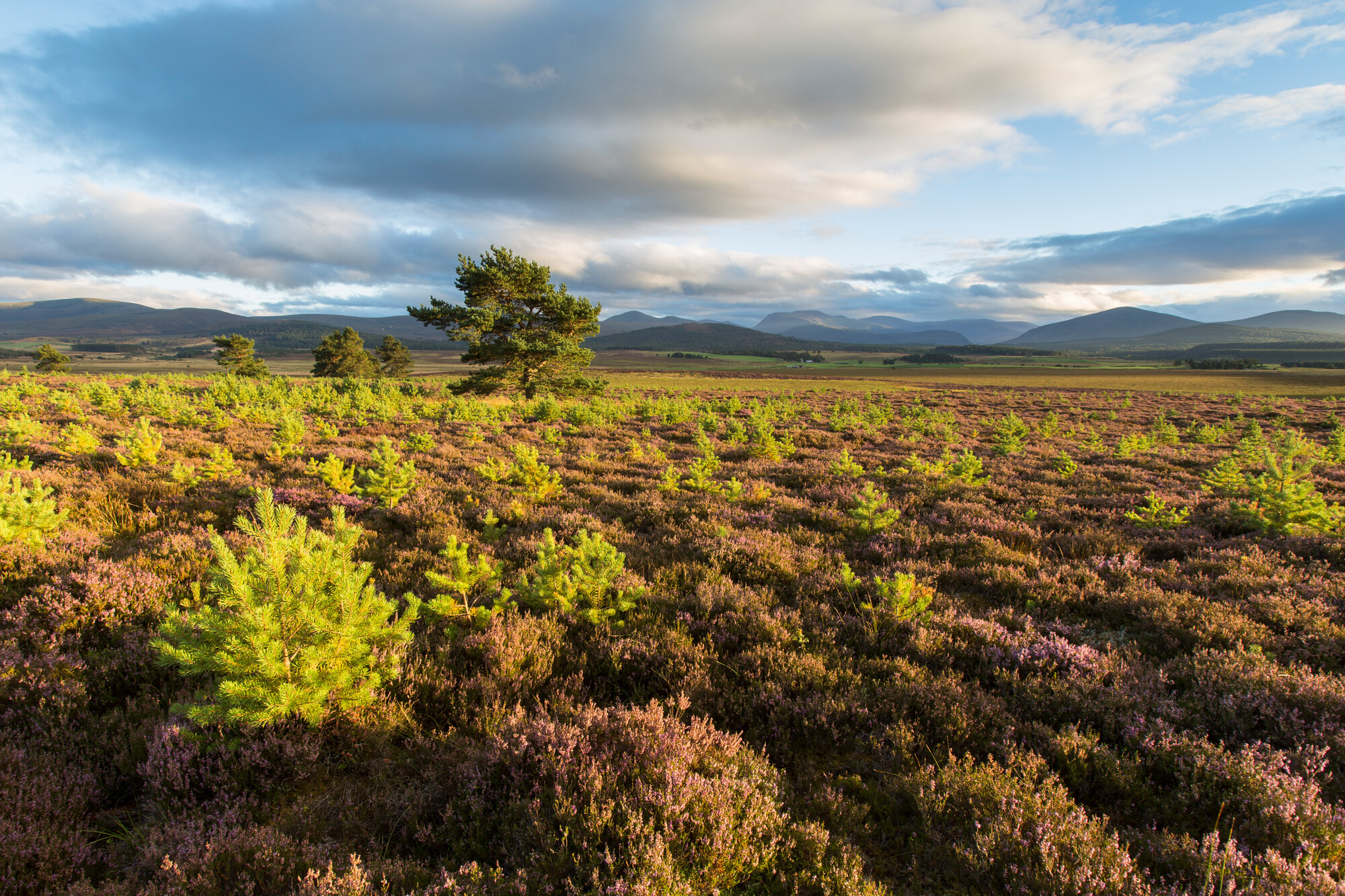
- Surrounding the Burn and road is largely rough grassland and agricultural fields. The site sits at the transition point between the River Dulnain’s flat, grassed floodplain used for grazing, and the upland heather moorland. There is a small group of mature Scots Pine trees around the upper part of Slugain Burn.
- Slugain Burn and the River Dulnain are both part of the River Spey Special Area of Conservation (SAC). The site also sits within Kinveachy Forest Special Protection Area (SPA), SAC and Site of Special Scientific Interest (SSSI).
Proposal
The drawings and documents associated with this application are listed below and are available on the Cairngorms National Park Authority website unless noted otherwise:
2026/0160/DET | Slugain Burn Restoration Project: River channel realignment, habitat restoration, road realignment, revised river crossing and installation of culvert | Land 1.4km Sw Of Inverlaidnan Station Road — Dalnahaitnach Carrbridge Highland
| Title | Drawing number | Date on plan* | Date received |
|---|---|---|---|
| Plan — Site Location Plan | PQZ-JBA-00 – 00-DR-C-001- | 29/04/2026 | 22/05/2026 |
Item 5 Planning Committee 9 October 2026
| Title | Drawing number | Date on plan* | Date received |
|---|---|---|---|
| Site_Location_Plan | PQZ-JBA-00 – 00-DR-C-001- | 29/04/2026 | 22/05/2026 |
| Plan – Proposed Site Layout: General Arrangement 1 | PQZ-JBA-00 – 00-DR-C-003-General_Arrangement_1_of_2 | 29/04/2026 | 22/05/2026 |
| Plan – General Arrangement 2 | PQZ-JBA-00 – 00-DR-C-004-General_Arrangement_2_of_2 | 31/03/2026 | 22/05/2026 |
| Plan – Proposed General Plan – Non-technical overview | PQZ-JBA-00 – 00-DR-C-0012-Non-Technical_Overview_Plan | 31/03/2026 | 22/05/2026 |
| Plan — General Plan – Structural General Arrangement | PQZ-JBA-00 – 00-DR-S-013-Structural_General_Arrangement | 31/03/2026 | 22/05/2026 |
| Plan – Step pool details | PQZ-JBA-00 – 00-DR-C-011-Step-Pool-Details | 31/03/2026 | 22/05/2026 |
| Plan — Site Clearance | PQZ-JBA-00 – 00-DR-C-002-Site-Clearance | 29/04/2026 | 22/05/2026 |
| Plan – Section Plan (Standard Details) | PQZ-JBA-00 – 00-DR-C-010-Standard-Details | 31/03/2026 | 22/05/2026 |
| Plan — Sections 1 | PQZ-JBA-00 – 00-DR-S-014-Sections_1_of_2 | 31/03/2026 | 22/05/2026 |
Item 5 Planning Committee 9 October 2026
| Title | Drawing number | Date on plan* | Date received |
|---|---|---|---|
| Plan — Sections 2 | PQZ-JBA-XX-XX-M3-S-0001-Design PQZ-JBA-00 – 00-DR-S-015-Sections_2_of_2 | 31/03/2026 | 22/05/2026 |
| Plan — Section Plan Channel 1 | PQZ-JBA-00 – 00-DR-C-005-Channel_Long_Section_1_of_2 | 31/03/2026 | 22/05/2026 |
| Plan — Section Plan Channel 2 | PQZ-JBA-00 – 00-DR-C-006-Channel_Long_Section_2_of_2 | 31/03/2026 | 22/05/2026 |
| Plan – Road Long Section | PQZ-JBA-00 – 00-DR-C-007-Road_Long_Section | 31/03/2026 | 22/05/2026 |
| Other – Planning Design and Access Statement | NBE-JBAU-XX-XX-RP-EN-0003-PDAS | 01/04/2026 | 22/05/2026 |
| Other — Flood Risk Assessment | PQZ-JBA-XX-XX-HM-0001 | 01/04/2026 | 22/05/2026 |
| Other – Ground Investigation Report | PQZ-JBA-XX-XX-RP-GT-0004 | 01/03/2026 | 22/05/2026 |
| Other – Preliminary Ecological Appraisal | PQZ-JBA-XX-XX-RP-EN-0002-PEAR | 04/02/2026 | 22/05/2026 |
| Other — Species Protection Plan | n/a | 22/05/2026 | |
| Other — Dalnahitnach Wader Survey | n/a | 22/05/2026 | |
| Other – Salmonid Surveys for Slugain Burn | n/a | 22/05/2026 | |
| Other — Supporting Statement | n/a | 08/09/2026 |
*Where no specific day of month has been provided on the plan, the system defaults to the first of the month.
- This application seeks planning permission for the realignment of the lower section of the Slugain Burn river channel along with the realignment of a section of minor road (U2239) and the creation of a new river crossing near Dalnahaitnach.
- Slugain Burn drains an upland catchment of 5.4km² and transports a large sediment load downstream. The Burn was historically straightened and reprofiled with embankments where it crosses the Dalnahaitnach floodplain to its confluence with the River Dulnain.
Item 5 Planning Committee 9 October 2026
- Upstream of the straightened channel, the burn flows under a low clearance bridge which according to the applicant’s supporting information causes water to back up and sediment deposits which have required regular dredging. The burn has breached its eastern bank upstream of the bridge more frequently in recent years causing flooding and sediment deposits on the road and in the fields to the east.
- The Slugain Burn restoration project aims to restore natural river and floodplain processes, improve and create habitats and create a low-maintenance and resilient watercourse.
- The proposal will lengthen the lower section of Slugain Burn where it crosses the Dalnahaitnach floodplain from approximately 165 metres of straightened, perched and embanked watercourse to approximately 1.5km long channel to the northeast where geomorphic processes can evolve more naturally to create diverse habitats within the channel and deliver better floodplain connectivity.
- The realignment will be done by diverting the Slugain Burn into a new channel which will connect with an existing minor watercourse to the northwest, that then links to the floodplain and River Dulnain approximately 1.5km further downstream.
- The course of the new realigned burn is split into three reaches. The first is the upstream reach which comprises of 80m of a step-pool system of varying dimensions to create a more natural form through this section. Step pools consist of alternating vertical drops over large rocks and boulders and pools of deeper water. The steps will be between 20 and 30cm high and between 5 and 7 metres apart. The deepest point of each step will be 0.6 metres. This section will be set within a two-stage channel designed to contain a 200-year flood risk plus climate change flow. The bed of the new channel will be made from dredged material from the site and the bed and the embankments of the existing channel.
Item 5 Planning Committee 9 October 2026
- The next stage or ‘middle reach’ continues along the newly excavated channel and transitions into a pool and riffle formation which consists of a sequence of areas of deeper water (pools) alternating with areas of shallower water created by coarse gravel material (riffles). The Planning, Design and Access Statement states that, this system will ‘provide fish and insect habitat and help to oxygenate the water’.
- The channel then joins the pre-existing minor watercourse in the final ‘lower reach’ which it will follow to its confluence with the River Dulnain. The downstream channel of the burn will be left to evolve naturally over time across the floodplain where the water will be able to then reshape the channel’s bed materials and form its own channels down to the confluence with the River Dulnain.
- A bund will be formed along the northwestern edge of the realigned burn at the step pools section and further earthworks will be undertaken to create the channel and pool-riffle section beyond it.
- In addition to the realigned channel, a 100-metre section of the existing road (U2239) to Dalnahaitnach will be removed and realigned with a new crossing over the burn channel that can withstand future flooding (1 in 200 year) and climate change impacts. The new crossing will be created using a long box concrete culvert unit with supporting headwalls. The culvert will be 5.1 metres wide, 2.15 metres high and 4.5 metres long. The new 3.3m wide road will be edged by grassed slopes and finished in asphalt in keeping with and connecting to the existing road. Under the crossing, the channel of the Burn will have a cast in situ base slab and walls. The area between the channel and realigned road will be regraded into a slope.
- The section of existing road that has been realigned will be removed and infilled and the existing bridge will be demolished. The redundant burn channel will be infilled with locally won material, and the road will be reinstated over where the bridge previously was. There will be post and wire fencing installed across the infilled straight channel as well as along the left bank of the new connecting channel to maintain the existing field boundary.
- The informal car park will be retained. The bunded gravels within the car park will be re-distributed to create a flat surface for parking.
History
- There is no recent planning history on or near the application site.
Item 5 Planning Committee 9 October 2026
Habitats Regulations Appraisal
- A Habitats Regulations Appraisal (HRA) has been undertaken to consider the potential effects of the development upon the conservation objectives of the European sites listed within the HRA document, which is attached as Appendix 2.
- Slugain Burn is a designated tributary of the River Spey SAC, which is designated for its Atlantic salmon, freshwater pearl mussel, sea lamprey, and otter interests. Realignment works along this historically straightened section of the Slugain Burn will directly impact the River Spey SAC. There is the potential for short term effects from construction activity including disturbance, pollution and from the loss of the existing lower Slugain Burn which will require mitigation measures to be conditioned. However, the proposal aims to reinstate natural geomorphic processes, enhance habitat provision and diversity as well as contributing to natural flood risk management and improving climate change resilience. Therefore, it is deemed that this river restoration work should improve suitable habitat diversity and potentially increase distribution of qualifying interests.
- Construction activity will take place within the boundaries of Kinveachy Forest SPA, designated for capercaillie and Scottish crossbill. It is possible that construction activity during the breeding season could lead to disturbance. However, due to existing recreational use by walkers/dog walkers, the proposed construction activity within the development site will not significantly increase the risk of disturbance to breeding capercaillie that could result in a change in the distribution of capercaillie within the SPA or the wider capercaillie metapopulation.
- A number of mitigation measures are proposed which should be secured by condition. These include pre-construction checks for protected species, a pollution prevention plan with measures to control pollution and mobilised sediment (which will be included within a Construction Environmental Management Plan), timing works to avoid the Atlantic salmon spawning season (Mid-October to end of February), no introduction of trees, seeds or turves (to avoid introducing non-native species), avoiding any promotion of the informal car parking area adjacent to the site to avoid any additional disturbance of Kinveachy SPA and monitoring sediment erosion / deposition within the new channel for 5 years post construction to ensure there is sufficient flow depths for fish passage. This will ensure that all the conservation objectives can be met and that there will be no adverse effects on the integrity of the European Sites. NatureScot have confirmed agreement with the contents of the HRA and its conclusions.
Item 5 Planning Committee 9 October 2026
Development plan context
Policies
National Planning Framework 4 (NPF4) Scotland 2045
(Policies relevant to the assessment of this application are marked with a cross (x))
| National policy | ||
|---|---|---|
| Policy 1 | Tackling the climate and nature crises | X |
| Policy 2 | Climate mitigation and adaptation | X |
| Policy 3 | Biodiversity | X |
| Policy 4 | Natural places | X |
| Policy 5 | Soils | X |
| Policy 6 | Forestry, woodland and trees | |
| Policy 7 | Historic assets and places | X |
| Policy 8 | Green belts | |
| Policy 9 | Brownfield, vacant and derelict land, and empty buildings | |
| Policy 11 | Energy | |
| Policy 12 | Zero waste | |
| Policy 13 | Sustainable transport | X |
| Policy 14 | Design, quality and place | X |
| Policy 15 | Local living and 20 minute neighbourhoods | |
| Policy 16 | Quality homes | |
| Policy 17 | Rural homes | |
| Policy 18 | Infrastructure first | |
| Policy 19 | Heating and cooling | |
| Policy 20 | Blue and green infrastructure | X |
| Policy 21 | Play, recreation and sport | |
| Policy 22 | Flood risk and water management | X |
| Policy 23 | Health and safety | |
| Policy 24 | Digital infrastructure | |
| Policy 25 | Community wealth building | |
| Policy 26 | Business and industry | |
| Policy 27 | City, town, local and commercial centres | |
| Policy 28 | Retail |
Item 5 Planning Committee 9 October 2026
| National policy | |
|---|---|
| Policy 29 | Rural development |
| Policy 30 | Tourism |
| Policy 31 | Culture and creativity |
| Policy 32 | Aquaculture |
| Policy 33 | Minerals |
Strategic policy Cairngorms National Park Partnership Plan 2022 – 2027 Cairngorms National Park Local Development Plan (2021)
Local plan policy (Policies relevant to the assessment of this application are marked with a cross (x))
| Local plan policy | ||
|---|---|---|
| Policy 1 | New housing development | |
| Policy 2 | Supporting economic growth | |
| Policy 3 | Design and placemaking | X |
| Policy 4 | Natural heritage | X |
| Policy 5 | Landscape | X |
| Policy 6 | The siting and design of digital communications equipment | |
| Policy 7 | Renewable energy | |
| Policy 8 | Open space, sport and recreation | |
| Policy 9 | Cultural heritage | X |
| Policy 10 | Resources | X |
| Policy 11 | Developer obligations |
- All new development proposals require to be assessed in relation to policies contained in the adopted Development Plan which comprises National Planning Framework 4 (NPF4) and the Cairngorms National Park Local Development Plan 2021 (LDP). The full wording of policies can be found at: https://www.gov.scot/publications/national-planning-framework‑4/documents/ and at: https://cairngorms.co.uk/wp-content/uploads/2021/03/CNPA-LDP-2021-web.pdf
Item 5 Planning Committee 9 October 2026
Planning guidance
- Supplementary guidance also supports the Local Development Plan and provides more details about how to comply with the policies. Guidance that is relevant to this application is marked with a cross (x).
| Policy | ||
|---|---|---|
| Policy 1 | Housing supplementary guidance | |
| Policy 2 | Supporting economic growth non-statutory guidance | |
| Policy 3 | Design and placemaking non-statutory guidance | X |
| Policy 4 | Natural heritage non-statutory guidance | X |
| Policy 5 | Landscape non-statutory guidance | X |
| Policy 7 | Renewable energy non-statutory guidance | |
| Policy 8 | Open space, sport and recreation non-statutory guidance | |
| Policy 9 | Cultural heritage non-statutory guidance | X |
| Policy 10 | Resources non-statutory guidance | X |
| Policy 11 | Developer obligations supplementary guidance |
Consultations
- A summary of the main issues raised by consultees now follows:
- Scottish Environment Protection Agency (SEPA) do not object to the proposal. They are satisfied that the findings of the applicant’s Flood Risk Assessment (FRA) indicate that the proposed crossing will have sufficient capacity to convey the 1 in 200 year design flows with an allowance for climate change and also an additional freeboard allowance. This is a betterment on the existing crossing and will provide a reduction in flood risk to the road at the location of the crossing, which is currently impacted by exceedance events and blockage. They add that the existing crossing should be removed as proposed.
- Scottish Water has no objections, noting that no new connections will be permitted to their public combined sewer system.
- Spey Fishery Board was consulted and, at time of writing, no response has been received.
- The Highland Council’s Flood Risk Management Team do not object to the application. They note that flooding at this location affects access along the road and regularly deposits significant amounts of sediment creating a maintenance
Item 5 Planning Committee 9 October 2026
burden for the Council. The Team welcome the proposal to alleviate a flood risk concern in combination with the enhancement of a sensitive watercourse and valuable habitat associated with it. They support the application on account of the overall flood risk, public road and environmental benefits that it will provide.
- The Highland Council’s Transport Planning Team has no objection to the application and expect the proposed works to improve the resilience of the U2239 at this location and represent a positive improvement to the existing arrangement, replacing infrastructure that has been affected by flooding and sediment deposition issues. They are satisfied that whilst the proposal will replace and realign a short section of public road, it will not affect its route and will retain the informal parking at the end. The Transport Planning Team is also content that the road design including carriageway width, pavement construction, embankment design and replacement crossing is appropriate for the route. Given the remote location of the site and low levels of traffic on the road, the Transport Planning Team do not consider that a Construction Traffic Management Plan is required. They have however recommended two advisories regarding any temporary restrictions and Roads Construction Consent.
- The Highland Council Historic Environment (Archaeology) Team raised that the application impacts the ruinous remains of a group of buildings that are of local historic importance. It was requested that a condition should be applied requiring detailed photographic recording of the buildings to be undertaken prior to the commencement of the development. The information was subsequently provided by the applicant and the Archaeology Officer confirmed that no condition would now be required. However, they have provided an informative note that they request is added to any planning permission.
- Cairngorms National Park Authority’s Ecological Advice Officer notes that a Species Protection Plan (SPP) has been provided as part of the application and sets out mitigation measures which should be conditioned and fully implemented, including pre-construction checks for protected species, having an experienced aquatic Ecological Clerk of Works present during any works in-river, and measures to control sediment mobilisation, pollution prevention and the spread of disease and invasive species. The SPP also sets out that works will be programmed to avoid the bird breeding season, the Atlantic Salmon spawning season and that a Construction Environmental Management Plan (CEMP) with Pollution Prevention Plan (PPP) will be prepared to mitigate any impacts on the River Spey SAC.
- The Officer also recommends that there should be no promotion of the access and existing parking area for recreational use to mitigate impacts on capercaillie and other species. In addition, no seeds, plants or turves should be introduced from
Item 5 Planning Committee 9 October 2026
outside the site to ensure that no non-native species will impact the pine woodland of the SSSI. Monitoring of sediment erosion/deposition within the new channel should also be undertaken for at least 5 years post-construction to ensure that flow depths are sufficient for fish passage through the realigned channel. If monitoring identifies restricted fish-passage or a decrease in average flows for a period lasting more than 6 months, then adjustments should be undertaken in consultation with a geomorphologist to restore fish passage.
- Overall, the Officer concludes that the development should result in a greater diversity of naturalised habitats within the channel of the Slugain Burn and increase the extent and quality of habitat for Atlantic salmon. In addition, the works should restore better connectivity of the Slugain Burn with its floodplain and improve habitat for a wide range of species including waders and priority invertebrates.
- Cairngorms National Park Authority’s Landscape Advisor states that the proposed restoration works would, over the longer term, contribute to the enhancement of the landscape in this part of the National Park. They have noted one suggestion to space the riffle and step pools more irregularly along the proposed new channel to give a more natural appearance.
- Cairngorms National Park Authority’s Agricultural Advisor is satisfied that the proposal will build catchment resilience and creates a net gain in an area that will be available for grazing. They note that the area isn’t highly productive and will not be adversely impacted by the realignment.
- Cairngorms National Park Authority’s Outdoor Access Officer does not object to the proposal. They note that there is a Right of Way close to and through a small part of the site but there is no established route on the ground. They do not consider that the proposal would have any adverse impact on the Right of Way or wider access in the area.
- Carrbridge Community Council were consulted but no response has been received.
Representations
- No representations have been received.
Item 5 Planning Committee 9 October 2026
Appraisal
- Section 25 of the 1997 Act as amended requires applications to be determined in accordance with the Development Plan. This comprises National Planning Framework 4 (NPF4) and the Cairngorms National Park Local Development Plan 2021 (LDP). Where there is conflict between policies, NPF4 policies take precedence.
- The main planning considerations in this case are: the principle of development; landscape; ecology; flood risk; roads and outdoor access; and cultural heritage. These are considered in detail below.
Principle of development
- NPF4 Policy 1: Tackling the climate and nature crises seeks to ensure that significant weight is given to the global climate and nature crises when considering all development proposals, whilst NPF4 Policy 2: Climate mitigation and adaptation