
Item5 NMU committee report 20250109DET
Cairngorms National Park Authority Ughdarras Pàirc Nàiseanta a’ Mhonaidh Ruaidh
Item 5 Planning Committee 28 August 2026 Page 1 of 54
Committee report
Development proposed: Formation of 3m wide 9km long segregated non-motorised user route/path; Land between Aviemore and Carrbridge.
Reference: 2025/0109/DET Applicant: Transport Scotland Date called-in: 12 May 2025 Recommendation: Approve subject to recommended conditions Case officer: Heather Boswell, Senior Planning Officer
Cairngorms National Park Authority Ughdarras Pàirc Nàiseanta a’ Mhonaidh Ruaidh
Item 5 Planning Committee 28 August 2026 Page 2 of 54
(Image: Map showing the route between Aviemore and Carrbridge.)
(Data source: CNPA Crown copyright and database rights 2026. Ordnance Survey AC0000821810 OS licensed colour raster MM (NG): Built environment CNP: CNPA @Crown copyright and database rights 2023 OS 160040965 OS licensed colour MM (NG): The representation of features or boundaries in which CNPA or others have an interest does not necessarily imply their true positions. For further information please contact the appropriate authority. This map has been produced to aid in the statutory process of dealing with planning applications. The map is to help identify the site and its surroundings and to aid Planning Officers, Committee Members and the Public in the determination of the proposal. Maps shown in the Planning Committee Report can only be used for the purposes of the Planning Committee. Any other use risks infringing Crown Copyright and may lead to prosecution or civil proceedings. Maps produced within this Planning Committee Report can only be reproduced with the express permission of the Cairngorms National Park Authority and other Copyright holders. This permission must be granted in advance.
Cairngorms National Park Authority Ughdarras Pàirc Nàiseanta a’ Mhonaidh Ruaidh
Item 5 Planning Committee 28 August 2026 Page 3 of 54
Site description, proposal and history
Site description
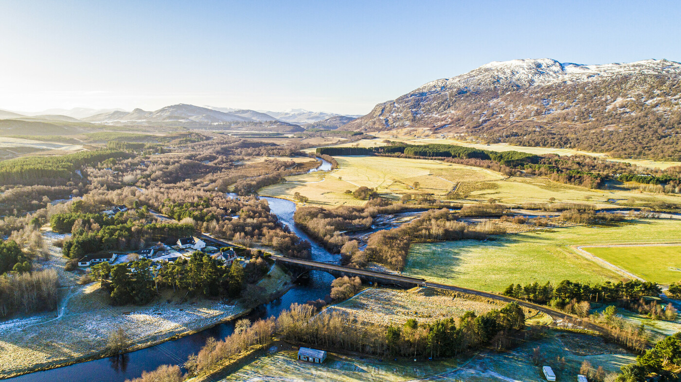
The application site runs in a north south orientation from Carrbridge to Aviemore. At the southern end of the proposal site the route starts at Dougal Drive, Aviemore and at its northern end the route terminates at the southern extents of Carrbridge. Outwith Aviemore and Carrbridge the application site is predominantly rural in character with scattered settlements and built form present.
The application site interacts with a variety of existing land uses including, but not limited to, existing public footpaths, trunk road(s) and verges, farmland, woodland including ancient woodland and veteran trees, sporting estates, the Highland Main Line railway, private residences, commercial properties, access routes and utilities.
The application site is within close proximity (2km) of the following environmentally designated sites: a) Loch Vaa Special Protection Area (SPA) b) Kinveachy Forest SPA c) River Spey Special Area of Conservation (SAC) d) Kinveachy Forest SAC e) Craigellachie National Nature Reserve (NNR) f) Craigellachie Site of Special Scientific Interest (SSSI) g) Loch Vaa SSSI h) River Spey SSSI i) Kinveachy Forest SSSI
Proposal
- The drawings and documents associated with this application are listed below and are available on the Cairngorms National Park Authority website unless noted otherwise: https://www.eplanningcnpa.co.uk/online-applications/caseDetails.do?keyVal=SVMLLGSI0CP00&caseType=Application https://www.eplanningcnpa.co.uk/online-applications/
Cairngorms National Park Authority Ughdarras Pàirc Nàiseanta a’ Mhonaidh Ruaidh
Item 5 Planning Committee 28 August 2026 Page 4 of 54
| Title | Drawing Number | Date on Plan* | Date Received |
|---|---|---|---|
| Plan — Location Plan — Sheet 1 of 3 | ACNMU — AMJ — HGN — A_ZZZZZ_ZZ — DR — RD — 0001 P03 | 14/03/25 | 02/05/25 |
| Plan — Location Plan — Sheet 2 of 3 | ACNMU — AMJ — HGN — A_ZZZZZ_ZZ — DR — RD — 0002 P03 | 14/03/25 | 02/05/25 |
| Plan — Location Plan — Sheet 3 of 3 | ACNMU — AMJ — HGN — A_ZZZZZ_ZZ — DR — RD — 0003 P03 | 14/03/25 | 02/05/25 |
| Plan — ACNMU Location Plan | ACNMU — AMJ — HGN — A_ZZZZZ_ZZ — DR — RD — 0002 P05 | 14/03/25 | 02/05/25 |
| Plan — Site Section Plan — Avielochan Farm Reinforced Earthworks Slope General Arrangement & Typical Details | ACNMU — AMJ — SGT — A_MLZZZ_XX — DR — GE — 0001 P03 | 14/03/25 | 02/05/25 |
| Plan — General Plan — Elevation & Sections — Birch View L Shaped Retaining Wall | ACNMU — AMJ — SRW — X_SRBRV_ST — DR — ST — 0001 P03 | 14/03/25 | 02/05/25 |
| Plan — General Plan — Elevation & Sections — The Knoll L Shaped Retaining Wall | ACNMU — AMJ — SRW — X_SRKNO_ST — 0001 P03 | 14/03/25 | 02/05/25 |
| Plan — Drainage Layout Plan — Watercourse Realignment Sheet 1 of 11 | ACNMU — AMJ — HDG — A_MLZZZ_WV — DR — DE — 0001 P03 | 14/03/25 | 02/05/25 |
| Plan — Drainage Layout Plan — Watercourse Realignment Sheet 2 of 11 | ACNMU — AMJ — HDG — A_MLZZZ_WV — DR — DE — 0002 P03 | 14/03/25 | 02/05/25 |
Cairngorms National Park Authority Ughdarras Pàirc Nàiseanta a’ Mhonaidh Ruaidh
Item 5 Planning Committee 28 August 2026 Page 5 of 54
| Plan — Drainage Layout Plan — Watercourse Realignment Sheet 3 of 11 | ACNMU — AMJ — HDG — A_MLZZZ_WV — DR — DE — 0003 P03 | 14/03/25 | 02/05/25 |
|---|---|---|---|
| Plan — Drainage Layout Plan — Watercourse Realignment Sheet 4 of 11 | ACNMU — AMJ — HDG — A_MLZZZ_WV — DR — DE — 0004 P03 | 14/03/25 | 02/05/25 |
| Plan — Drainage Layout Plan — Watercourse Realignment Sheet 5 of 11 | ACNMU — AMJ — HDG — A_MLZZZ_WV — DR — DE — 0005 P03 | 14/03/25 | 02/05/25 |
| Plan — Drainage Layout Plan — Watercourse Realignment Sheet 6 of 11 | ACNMU — AMJ — HDG — A_MLZZZ_WV — DR — DE — 0006 P03 | 14/03/25 | 02/05/25 |
| Plan — Drainage Layout Plan — Watercourse Realignment Sheet 7 of 11 | ACNMU — AMJ — HDG — A_MLZZZ_WV — DR — DE — 0007 P03 | 14/03/25 | 02/05/25 |
| Plan — Drainage Layout Plan — Watercourse Realignment Sheet 8 of 11 | ACNMU — AMJ — HDG — A_MLZZZ_WV — DR — DE — 0008 P03 | 14/03/25 | 02/05/25 |
| Plan — Drainage Layout Plan — Watercourse Realignment Sheet 9 of 11 | ACNMU — AMJ — HDG — A_MLZZZ_WV — DR — DE — 0009 P03 | 14/03/25 | 02/05/25 |
| Plan — Drainage Layout Plan — Watercourse Realignment Sheet 10 of 11 | ACNMU — AMJ — HDG — A_MLZZZ_WV — DR — DE — 0010 P03 | 14/03/25 | 02/05/25 |
| Plan — Drainage Layout Plan — Watercourse Realignment Sheet 11 of 11 | ACNMU — AMJ — HDG — A_MLZZZ_WV — DR — DE — 0011 P03 | 14/03/25 | 02/05/25 |
| Plan — Drainage Strategy — Typical Details | ACNMU — AMJ — HDG — A_ZZXXX_ZZ — DR — DE — 0001 P02 | 14/03/25 | 02/05/25 |
| Plan — Drainage Strategy — Typical Cross Sections (1 of 2) | ACNMU — AMJ — HDG — A_ZZXSE_ZZ — DR — DE — 0521 P02 | 14/03/25 | 02/05/25 |
Cairngorms National Park Authority Ughdarras Pàirc Nàiseanta a’ Mhonaidh Ruaidh
Item 5 Planning Committee 28 August 2026 Page 6 of 54
| Plan — Drainage Strategy — Typical Cross Sections (2 of 2) | ACNMU — AMJ — HDG — A_ZZXSE_ZZ — DR — DE — 0522 P02 | 14/03/25 | 02/05/25 |
|---|---|---|---|
| Plan — Section Plan — Feith Mhor Culvert Extension | ACNMU — AMJ — SMN — X_CVFMH_CV — DR — ST — 0001 P02 | 14/03/25 | 05/05/25 |
| Plan — Section Plan — Network Rail Embankment Reinforced Earthworks Slope General Arrangement & Typical Details | ACNMU — AMJ — SGT — A_MLZZZ_XX — DR — GE — 0002 P03 | 14/03/25 | 05/05/25 |
| Plan — Section Plan — Standard Kerb Detail | ACNMU — AMJ — HKF — X_ZZZZZ_ZZ — DE — CI — 0001 | 14/03/25 | 05/05/25 |
| Plan — Location Plan — Planning Boundary — 1 of 15 | ACNMU — AMJ — HGN — A_MLZZZ_ZZ — DR — ZZ — 0001 P04 | 14/03/25 | 05/05/25 |
| Plan — Location Plan — Planning Boundary — 2 of 15 | ACNMU — AMJ — HGN — A_MLZZZ_ZZ — DR — ZZ — 0002 P04 | 14/03/25 | 05/05/25 |
| Plan — Location Plan — Planning Boundary — 3 of 15 | ACNMU — AMJ — HGN — A_MLZZZ_ZZ — DR — ZZ — 0003 P04 | 14/03/25 | 05/05/25 |
| Plan — Location Plan — Planning Boundary — 4 of 15 | ACNMU — AMJ — HGN — A_MLZZZ_ZZ — DR — ZZ — 0004 P04 | 14/03/25 | 05/05/25 |
| Plan — Location Plan — Planning Boundary — 5 of 15 | ACNMU — AMJ — HGN — A_MLZZZ_ZZ — DR — ZZ — 0005 P04 | 14/03/25 | 05/05/25 |
| Plan — Location Plan — Planning Boundary — 6 of 15 | ACNMU — AMJ — HGN — A_MLZZZ_ZZ — DR — ZZ — 0006 P04 | 14/03/25 | 05/05/25 |
| Plan — Location Plan — Planning Boundary — 7 of 15 | ACNMU — AMJ — HGN — A_MLZZZ_ZZ — DR — ZZ — 0007 P04 | 14/03/25 | 05/05/25 |
Cairngorms National Park Authority Ughdarras Pàirc Nàiseanta a’ Mhonaidh Ruaidh
Item 5 Planning Committee 28 August 2026 Page 7 of 54
| Plan — Location Plan — Planning Boundary — 8 of 15 | ACNMU — AMJ — HGN — A_MLZZZ_ZZ — DR — ZZ — 0008 P04 | 14/03/25 | 05/05/25 |
|---|---|---|---|
| Plan — Location Plan — Planning Boundary — 9 of 15 | ACNMU — AMJ — HGN — A_MLZZZ_ZZ — DR — ZZ — 0009 P04 | 14/03/25 | 05/05/25 |
| Plan — Location Plan — Planning Boundary — 10 of 15 | ACNMU — AMJ — HGN — A_MLZZZ_ZZ — DR — ZZ — 0010 P04 | 14/03/25 | 05/05/25 |
| Plan — Location Plan — Planning Boundary — 11 of 15 | ACNMU — AMJ — HGN — A_MLZZZ_ZZ — DR — ZZ — 0011 P04 | 14/03/25 | 05/05/25 |
| Plan — Location Plan — Planning Boundary — 12 of 15 | ACNMU — AMJ — HGN — A_MLZZZ_ZZ — DR — ZZ — 0012 P04 | 14/03/25 | 05/05/25 |
| Plan — Location Plan — Planning Boundary — 13 of 15 | ACNMU — AMJ — HGN — A_MLZZZ_ZZ — DR — ZZ — 0013 P04 | 14/03/25 | 05/05/25 |
| Plan — Location Plan — Planning Boundary — 14 of 15 | ACNMU — AMJ — HGN — A_MLZZZ_ZZ — DR — ZZ — 0014 P04 | 14/03/25 | 05/05/25 |
| Plan — Location Plan — Planning Boundary — 15 of 15 | ACNMU — AMJ — HGN — A_MLZZZ_ZZ — DR — ZZ — 0015 P04 | 14/03/25 | 05/05/25 |
| Plan — Site Level Plan — ACNMU Mainline Plan and Profile Sheet 1 of 14 | ACNMU — AMJ — HML — A_ML000_ZZ — DR — RD — 0001 P04 | 14/03/25 | 05/05/25 |
| Plan — Site Level Plan — ACNMU Mainline Plan and Profile Sheet 2 of 14 | ACNMU — AMJ — HML — A_ML000_ZZ — DR — RD — 0002 P04 | 14/03/25 | 05/05/25 |
| Plan — Site Level Plan — ACNMU Mainline Plan and Profile Sheet 3 of 14 | ACNMU — AMJ — HML — A_ML000_ZZ — DR — RD — 0003 P04 | 14/03/25 | 05/05/25 |
| Plan — Site Level Plan — ACNMU Mainline Plan and Profile Sheet 4 of 14 | ACNMU — AMJ — HML — A_ML000_ZZ — DR — RD — 0004 P04 | 14/03/25 | 05/05/25 |
Cairngorms National Park Authority Ughdarras Pàirc Nàiseanta a’ Mhonaidh Ruaidh
Item 5 Planning Committee 28 August 2026 Page 8 of 54
| Plan — Site Level Plan — ACNMU Mainline Plan and Profile Sheet 5 of 14 | ACNMU — AMJ — HML — A_ML000_ZZ — DR — RD — 0005 P04 | 14/03/25 | 05/05/25 |
|---|---|---|---|
| Plan — Site Level Plan — ACNMU Mainline Plan and Profile Sheet 6 of 14 | ACNMU — AMJ — HML — A_ML000_ZZ — DR — RD — 0006 P04 | 14/03/25 | 05/05/25 |
| Plan — Site Level Plan — ACNMU Mainline Plan and Profile Sheet 7 of 14 | ACNMU — AMJ — HML — A_ML000_ZZ — DR — RD — 0007 P04 | 14/03/25 | 05/05/25 |
| Plan — Site Level Plan — ACNMU Mainline Plan and Profile Sheet 8 of 14 | ACNMU — AMJ — HML — A_ML000_ZZ — DR — RD — 0008 P04 | 14/03/25 | 05/05/25 |
| Plan — Site Level Plan — ACNMU Mainline Plan and Profile Sheet 9 of 14 | ACNMU — AMJ — HML — A_ML000_ZZ — DR — RD — 0009 P04 | 14/03/25 | 05/05/25 |
| Plan — Site Level Plan — ACNMU Mainline Plan and Profile Sheet 10 of 14 | ACNMU — AMJ — HML — A_ML000_ZZ — DR — RD — 0010 P04 | 14/03/25 | 05/05/25 |
| Plan — Site Level Plan — ACNMU Mainline Plan and Profile Sheet 11 of 14 | ACNMU — AMJ — HML — A_ML000_ZZ — DR — RD — 0011 P04 | 14/03/25 | 05/05/25 |
| Plan — Site Level Plan — ACNMU Mainline Plan and Profile Sheet 12 of 14 | ACNMU — AMJ — HML — A_ML000_ZZ — DR — RD — 0012 P04 | 14/03/25 | 05/05/25 |
| Plan — Site Level Plan — ACNMU Mainline Plan and Profile Sheet 13 of 14 | ACNMU — AMJ — HML — A_ML000_ZZ — DR — RD — 0013 P04 | 14/03/25 | 05/05/25 |
| Plan — Site Level Plan — ACNMU Mainline Plan and Profile Sheet 14 of 14 | ACNMU — AMJ — HML — A_ML000_ZZ — DR — RD — 0014 P04 | 14/03/25 | 05/05/25 |
| Other — Transport Statement | 02/05/25 | ||
| Other — Traffic Management Plan | 02/05/25 | ||
| Other — Pre-Application Consultation Report | 02/05/25 |
Cairngorms National Park Authority Ughdarras Pàirc Nàiseanta a’ Mhonaidh Ruaidh
Item 5 Planning Committee 28 August 2026 Page 9 of 54
| Other — Planning Statement | 02/05/25 | |
|---|---|---|
| Other — Environmental Impact Assessment Report (EIAR) | (Including volumes 1 — 3 of the EIAR) | 05/05/25 |
| Other — Environmental Impact Assessment Report — Non-Technical Summary | 02/05/25 | |
| Other — Drainage Impact Assessment | 02/05/25 | |
| Other — Design and Access Statement | 02/05/25 | |
| Other — Habitats Regulations Appraisal | 05/05/25 | |
| Other — Public Engagement Events Summary Report | 27/05/25 | |
| Other — Habitats Regulations Appraisal | 04/08/26 | |
| Other — Capercaillie Assessment | 04/08/26 | |
| Other — Arboricultural Impact Assessment — Tree Schedule — Annex B | 18/12/25 | |
| Other — ACNMU — Planning Consultee Response to Aviemore and Vicinity Community Council | 03/06/26 | |
| Other — ACNMU — Planning Response — Compensatory Planting 2 | 03/06/26 | |
| Other — ACNMU — Planning Response to Environmental Health | 03/06/26 | |
| Other — ACNMU — Planning Consultee Response — Environment | 05/06/26 |
Cairngorms National Park Authority Ughdarras Pàirc Nàiseanta a’ Mhonaidh Ruaidh
Item 5 Planning Committee 28 August 2026 Page 10 of 54
| Other — ACNMU — Planning Consultee Response to Recreation and Outdoor Access | 05/06/26 |
|---|
The proposed development constitutes a largely segregated non-motorised user (NMU) active travel route, approximately 9km long, running between Aviemore in the south and Carrbridge in the north, as shown on the location plans in Appendix 1a. The route broadly follows the existing road corridors of the B9152, A95 and B9153 to provide a relatively direct NMU link between the two settlements.
The route will be predominantly 3 metres wide and will include sections of upgrades to existing paths as well as newly built sections. A sealed bituminous material will be used for surfacing with an aggregate sub-base. Four at grade junctions are proposed, including: a) A raised table zebra crossing at Dougal Drive; b) A signalised crossing immediately north of Granish Junction at the proposed A9 Dualling Granish roundabout; c) An uncontrolled crossing at Kinveachy Junction to tie into the existing National Cycle Network Route 7 (NCN 7); and d) An uncontrolled crossing south of Carrbridge to access the existing footway through the village.
In addition, the proposed route will cross 11 private accesses which take the form of simple priority junctions. These are generally agricultural field, forestry or private property accesses, with seven of these crossings already serving as existing NMU routes.
The proposed NMU route will pass under the existing Highland Main Line railway via the underpass at Kinveachy. Additional design details for the NMU route at this point will be provided at the finalised design stage, subject to the grant of planning consent.
Elements of biodiversity enhancement and compensatory woodland planting are proposed as part of the development. The location of existing ancient woodland along the extent of the proposed route is shown on Appendix 1b. Within the site boundary, an area for pond habitat compensation and separate area for compensatory woodland planting have been proposed. In addition, the Applicant intends to develop a species rich grassland mix which would enhance floral species diversity along the proposed route and introduce a pollinator corridor. This corridor
Cairngorms National Park Authority Ughdarras Pàirc Nàiseanta a’ Mhonaidh Ruaidh
Item 5 Planning Committee 28 August 2026 Page 11 of 54
would provide important habitat for pollinator species and improve connectivity between existing habitats.
Off-site compensatory woodland planting is also proposed to mitigate against the loss of woodland associated with the development. This off-site planting would connect into the compensatory woodland planting areas already agreed through the consenting process for the A9 Dualling Dalraddy to Slochd project and is expected to enhance the ecological connectivity and functionality of the woodland network. Further details of the off-site compensatory woodland planting will be provided as part of the Dalraddy to Slochd Scheme Woodland Creation Method Statement and Habitat Management Plan (WCMSHMP) once agreed with stakeholders.
The proposal is a major application under the terms of the Scottish Government’s hierarchy of development and therefore required pre-application consultation prior to the submission of the planning application.
The following supporting documents accompany the application: a) Design and Access Statement: explains the background to the development and aspirations of the proposed scheme, the characteristics of the preferred route and the design response, as well as how the scheme addresses inclusive access for all non-motorised users. b) Drainage Impact Assessment: demonstrates existing drainage conditions and proposals to ensure that compliant drainage design can be constructed to ensure no risk to property, the public or the natural environment. c) Planning Statement: provides an overview of the development and outlines relevant planning policies, indicating compliance with the development plan. d) Pre-application Consultation Report: provides evidence that the project’s public engagement and consultation were undertaken in line with statutory requirements and outlines how feedback received helped to establish a preferred route design. e) Public Engagement Events Summary Report: details the Applicant’s approach to engagement and feedback received in relation to the proposal. f) Environmental Impact Assessment (EIA): examines the likely significant environmental effects of the proposed development and includes mitigation measures where adverse impacts are anticipated as a result of the proposed scheme. g) EIA Non-Technical Summary: provides an accessible summary of the EIA’s findings.
Cairngorms National Park Authority Ughdarras Pàirc Nàiseanta a’ Mhonaidh Ruaidh
Item 5 Planning Committee 28 August 2026 Page 12 of 54
h) Transport Statement: examines impacts on the existing road network, priority accesses at junctions, and adjacent NMU routes during construction and operation. i) Traffic Management Plan: provides an overview of the types of traffic management that are likely to be used during construction. j) Habitats Regulations Appraisal (HRA): A ‘shadow’ HRA undertaken by the Applicant to help inform the formal HRA undertaken by the Park Authority as the competent authority (see more information on HRA below).
History
- The development site extends across a substantial area between Aviemore and Carrbridge and parts of the site have been subject to various planning applications in the past. However, these applications relate to different types of development and are not directly relevant to the proposed NMU route or material to the assessment of this application.
Habitats Regulations Appraisal
A Habitats Regulations Appraisal (HRA) has been undertaken to consider the potential effects of the development upon the conservation objectives of the European sites listed within the HRA document, which is attached as Appendix 2. The European sites are: a) Loch Vaa SPA; b) River Spey SAC; c) Kinveachy Forest SPA; d) Cairngorms SPA; e) Abernethy Forest SPA; f) Craigmore Wood SPA; and g) Anagach Woods SPA.
Additionally, the HRA assesses the potential impact upon protected species found within these SPAs and SACs, such as Slavonian grebe, freshwater pearl mussels, sea lamprey, Atlantic salmon, otter, capercaillie, Scottish crossbill, golden eagle, dotterel, merlin, peregrine, and osprey.
The HRA concludes that there will be no adverse effects to the integrity of the relevant European sites, providing that mitigation measures outlined in the planning application, as well as amendments to these measures recommended as part of the HRA, are secured by conditions attached to any planning permission.
NatureScot have confirmed agreement with the HRA and its conclusions.
Cairngorms National Park Authority Ughdarras Pàirc Nàiseanta a’ Mhonaidh Ruaidh
Item 5 Planning Committee 28 August 2026 Page 13 of 54
Development plan context
Policies
National policy
| National Planning Framework 4 (NPF4) Scotland 2045 (Policies relevant to the assessment of this application are marked with a cross (x)) | |
|---|---|
| Policy 1 Tackling the climate and nature crises | X |
| Policy 2 Climate mitigation and adaptation | X |
| Policy 3 Biodiversity | X |
| Policy 4 Natural places | X |
| Policy 5 Soils | X |
| Policy 6 Forestry, woodland and trees | X |
| Policy 7 Historic assets and places | X |
| Policy 8 Green belts | |
| Policy 9 Brownfield, vacant and derelict land, and empty buildings | |
| Policy 11 Energy | |
| Policy 12 Zero waste | |
| Policy 13 Sustainable transport | X |
| Policy 14 Design, quality and place | X |
| Policy 15 Local living and 20 minute neighbourhoods | X |
| Policy 16 Quality homes | |
| Policy 17 Rural homes | |
| Policy 18 Infrastructure first | |
| Policy 19 Heating and cooling | |
| Policy 20 Blue and green infrastructure | X |
| Policy 21 Play, recreation and sport | X |
| Policy 22 Flood risk and water management | X |
| Policy 23 Health and safety | X |
| Policy 24 Digital infrastructure | |
| Policy 25 Community wealth building | |
| Policy 26 Business and industry | |
| Policy 27 City, town, local and commercial centres |
Cairngorms National Park Authority Ughdarras Pàirc Nàiseanta a’ Mhonaidh Ruaidh
Item 5 Planning Committee 28 August 2026 Page 14 of 54
| Policy 28 Retail | |
|---|---|
| Policy 29 Rural development | |
| Policy 30 Tourism | |
| Policy 31 Culture and creativity | |
| Policy 32 Aquaculture | |
| Policy 33 Minerals |
Strategic policy Cairngorms National Park Partnership Plan 2022 – 2027
Local plan policy Cairngorms National Park Local Development Plan (2021) (Policies relevant to the assessment of this application are marked with a cross (x))
| Policy 1 New housing development | X |
|---|---|
| Policy 2 Supporting economic growth | X |
| Policy 3 Design and placemaking | X |
| Policy 4 Natural heritage | X |
| Policy 5 Landscape | X |
| Policy 6 The siting and design of digital communications equipment | |
| Policy 7 Renewable energy | |
| Policy 8 Open space, sport and recreation | X |
| Policy 9 Cultural heritage | X |
| Policy 10 Resources | X |
| Policy 11 Developer obligations |
- All new development proposals require to be assessed in relation to policies contained in the adopted Development Plan which comprises National Planning Framework 4 (NPF4) and the Cairngorms National Park Local Development Plan 2021 (LDP). The full wording of policies can be found at: https://www.gov.scot/publications/national-planning-framework‑4/documents/ and at: https://cairngorms.co.uk/wp-content/uploads/2021/03/CNPA-LDP-2021-web.pdf
Cairngorms National Park Authority Ughdarras Pàirc Nàiseanta a’ Mhonaidh Ruaidh
Item 5 Planning Committee 28 August 2026 Page 15 of 54
Planning guidance
- Supplementary guidance also supports the Local Development Plan (LDP) and provides more details about how to