
Item6 Old Bridge Inn Committee Report 20260104DET
Cairngorms National Park Authority Ughdarras Pàirc Nàiseanta a’ Mhonaidh Ruaidh
Item 6 Planning Committee 28 August 2026
Committee report
Development proposed: Installation of raised decking for outdoor eating / drinking; provision of 10 car parking spaces; and provision of picnic tables at Old Bridge Inn, 23 Dalfaber Road, Aviemore, PH22 1PU
Reference: 2026/0104/DET Applicant: Mr Owen Caldwell Date called-in: 30 March 2026 Recommendation: Approve subject to conditions Case officer: Katie Crerar, Planning Officer
(Map showing the development site and surrounding area, including Aviemore, Dalfaber Road, and the River Spey. The site is highlighted with a red boundary, showing an “Outfall” and “Pipeline” nearby.)
Data source: CNPA Crown copyright and database rights 2026. Ordnance Survey AC0000821810 OS licensed colour raster MM (NG): OS Built licensed environment colour CNP: MM (NG): CNPA The @Crown representation copyright of and features database or boundaries rights 2023 in OS which 1600409657 CNPA or others others have an interest does not necessarily imply their true positions. For further information please contact the appropriate authority.
This map has been produced to aid in the statutory process of dealing with planning applications. The map is to help identify the site and its surroundings and to aid Planning Officers, Committee Members and the Public in the determination of the proposal. Maps shown in the Planning Committee Report can only be used for the purposes of the Planning Committee. Any other use risks infringing Crown Copyright and may lead to prosecution or civil proceedings. Maps produced within this Planning Committee Report can only be reproduced with the express permission of the Cairngorms National Park Authority and other Copyright holders. This permission must be granted in advance.
Site description, proposal and history
Site description
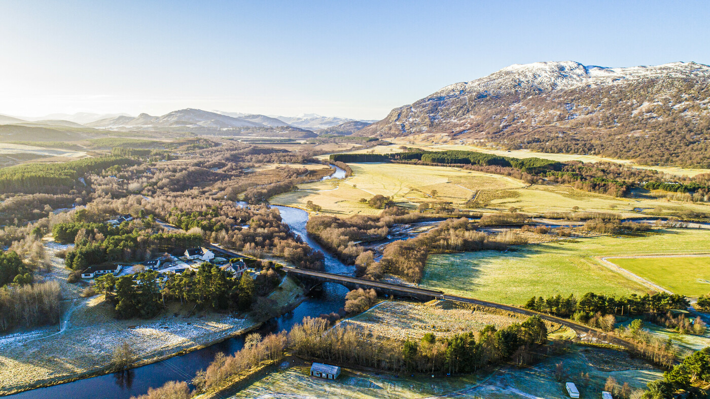
- The development site comprises a small area of cleared ground located between Dalfaber Road (adjacent to the Old Bridge Inn, Aviemore) and the River Spey.
- The site has limited vegetation due to existing use but is contained by woodland to the north and south, Dalfaber Road to the west and the River Spey to the east.
- The site was granted temporary consent (for two years) in March 2024 for use as a beer garden which also provided access to the River Spey, however this temporary permission has recently lapsed. Prior to this, it was used informally as a car park and picnic area, and the south east corner of the site is used as a launch point for people and groups using the River Spey for canoeing, kayaking and other uses. There is a core path (LBS137) running through the site providing access from Dalfaber Road to the river.
Proposal
The drawings and documents associated with this application are listed below and are available on the Cairngorms National Park Authority website unless noted otherwise:
2026/0104/DET | Installation of raised decking for outdoor eating/drinking; provision of 10 car parking spaces; and provision of picnic tables | Old Bridge Inn 23 Dalfaber Road Aviemore Highland PH22 1PU
Title Drawing number Date on plan* Date received Plan – Location Plan (Site Layout Plan) 100 01/02/26 26/03/26 Plan – Proposed Site Layout Plan (Updated) 101 01/02/26 27/05/26 Plan — Existing Plans and elevations 102 01/02/26 26/03/26 Plan – Proposed Plans and elevations 103 01/02/26 26/03/26 Other — Flood Risk Assessment 01/02/26 26/03/26 Other — Landscape Plan 01/04/2026 27/04/2026 Other — Supporting information for NPF4 Policy 3 Compliance (Biodiversity enhancement) 01/05/2026 25/05/2026 Other — Construction Method Statement 14/05/2026 27/05/2026 Other — Pollution Prevention Plan 01/05/2026 27/05/2026 Other — Preliminary Ecological Appraisal 01/05/2026 25/05/2026 Other — Tree Constraints Plan 25/06/2026 29/06/2026 Other – Tree Management During Site Construction Arboricultural Report 26/06/2026 29/06/2026 Other — Tree Protection Plan 25/06/2026 29/06/2026 *Where no specific day of month has been provided on the plan, the system defaults to the first of the month.
- This proposal seeks planning permission to create additional outdoor eating space and provide onsite parking as part of the Old Bridge Inn Restaurant. There is already an outdoor seating area serving the Inn known as ‘The Shelter’. This proposal will extend this seating area as well as adding picnic benches around the site and creating 10 formal parking spaces to expand the business and increase capacity during the busy summer season.
- The existing outdoor seating area will be extended to the east with timber decking measuring 4.5m by approximately 17.2m. The new decked extension will not be covered and will have 1.1m high timber railing around it with two openings on the western side to provide level access into the existing seating area. In addition, there will be an opening at the northern end of the new decking which will provide access via some stairs down to the lower part of the site where parking spaces are proposed (see Proposed Plans and Elevations at Appendix 1).
- 10 designated parking spaces are proposed on the site, with a row of four being positioned adjacent to the extended decking area, another four being located to the southeast of these in an ‘L’ shape, and the final two to the east. The parking spaces will be demarcated using horizontal timber markers on the outer edges. The central area between the parking spaces will be open for turning and to maintain core path access. The existing hard standing sand and gravel surface on the site will be retained.
- In addition to the decked extension and parking spaces, there will be picnic benches for customers to sit at in the northern part of the site and under the trees in the eastern part set back 10m from the river bank as previously.
- Three trees are proposed to be removed as part of the development – a Goat Willow (T2092) which lies within close proximity of the new decking, and a Common Alder and Silver Birch group (TG2082) which are decaying and standing deadwood which pose a safety risk as they are leaning towards the seating area.
- Compensatory planting for the removal of the three trees is proposed, which will comprise six broadleaf trees. In addition, biodiversity enhancement measures are proposed comprising six bat boxes, six bird nest boxes, native tree planting along the southern boundary of the site and raised planters with native wildflower mixes and native shrubs. The exact location of these have not yet been provided and will be confirmed prior to commencement of development if planning permission is granted.
- The site has been used as a beer garden for the last two years and this application seeks to continue a similar use permanently. The development site provides access to a launch point on the River Spey which is also part of a core path. The layout of the site will maintain unimpeded pedestrian access to the river. Due to the constraints of the applicant’s lease of the land, no provision for minibuses or canoe trailers to park and drop off canoes can be provided within the application site. However, the proposed layout has been designed to enable customers on the site to be more contained to specific areas which is intended to help maintain public right of access through the site.
History
- There have been two previous applications on the site which include: a) 2023/0399/DET — Change of use of land to beer garden (in retrospect), which was approved by the National Park Authority in March 2024 as a temporary consent for two years. b) 20/04604/FUL – Erection of outdoor shelter, approved by The Highland Council in February 2021.
Habitats Regulations Appraisal
- A Habitats Regulations Appraisal (HRA) has been undertaken to consider the potential effects of the development upon the conservation objectives of the European sites listed within the HRA document, which is attached as Appendix 2. The European site in this case is the River Spey Special Area of Conservation (SAC) which is designated for its otter, freshwater pearl mussels (FWPM), sea lamprey and Atlantic salmon interests.
- The HRA considers that due to the proximity of the development site to the River Spey, there is potential for indirect impacts on water quality. Pollution events during the construction phase could result in impacts on water quality or mobilised sediment entering the watercourse affecting Atlantic salmon, fresh water pearl mussels and juvenile sea lamprey. Whilst it is recognised that otters in this area will be habituated to existing levels of disturbance from recreational activity or temporary construction phase activity, there is also potential for construction phase pollution that could impact on otter habitats / food sources.
- Therefore, mitigation measures are proposed including the implementation of an otter Species Protection Plan and a Pollution Prevention Plan to reduce potential effects to a minimal level. This will ensure that all the conservation objectives can be met and that there will be no adverse effects on the integrity of the River Spey SAC. Naturescot have confirmed agreement with the contents of the HRA and its conclusions.
Development plan context
Policies
| National policy | National Planning Framework 4 (NPF4) Scotland 2045 (Policies relevant to the assessment of this application are marked with a cross (x)) | |
|---|---|---|
| Policy 1 | Tackling the climate and nature crises | X |
| Policy 2 | Climate mitigation and adaptation | X |
| Policy 3 | Biodiversity | X |
| Policy 4 | Natural places | X |
| Policy 5 | Soils | |
| Policy 6 | Forestry, woodland and trees | X |
| Policy 7 | Historic assets and places | |
| Policy 8 | Green belts | |
| Policy 9 | Brownfield, vacant and derelict land, and empty buildings | |
| Policy 11 | Energy | |
| Policy 12 | Zero waste | |
| Policy 13 | Sustainable transport | |
| Policy 14 | Design, quality and place | |
| Policy 15 | Local living and 20 minute neighbourhoods | |
| Policy 16 | Quality homes | |
| Policy 17 | Rural homes | |
| Policy 18 | Infrastructure first | |
| Policy 19 | Heating and cooling | |
| Policy 20 | Blue and green infrastructure | |
| Policy 21 | Play, recreation and sport | |
| Policy 22 | Flood risk and water management | X |
| Policy 23 | Health and safety | |
| Policy 24 | Digital infrastructure | |
| Policy 25 | Community wealth building | |
| Policy 26 | Business and industry | |
| Policy 27 | City, town, local and commercial centres | |
| Policy 28 | Retail | |
| Policy 29 | Rural development | |
| Policy 30 | Tourism | X |
| Policy 31 | Culture and creativity | |
| Policy 32 | Aquaculture | |
| Policy 33 | Minerals |
Strategic policy
Cairngorms National Park Partnership Plan 2022 – 2027 Cairngorms National Park Local Development Plan (2021)
Local plan policy
(Policies relevant to the assessment of this application are marked with a cross (x))
| Policy 1 | New housing development | |
|---|---|---|
| Policy 2 | Supporting economic growth | X |
| Policy 3 | Design and placemaking | X |
| Policy 4 | Natural heritage | X |
| Policy 5 | Landscape | X |
| Policy 6 | The siting and design of digital communications equipment | |
| Policy 7 | Renewable energy | |
| Policy 8 | Open space, sport and recreation | |
| Policy 9 | Cultural heritage | |
| Policy 10 | Resources | X |
| Policy 11 | Developer obligations |
- All new development proposals require to be assessed in relation to policies contained in the adopted Development Plan which comprises National Planning Framework 4 (NPF4) and the Cairngorms National Park Local Development Plan 2021 (LDP). The full wording of policies can be found at: https://www.gov.scot/publications/national-planning-framework‑4/documents/ and at: https://cairngorms.co.uk/wp-content/uploads/2021/03/CNPA-LDP-2021-web.pdf
Planning guidance
- Supplementary guidance also supports the Local Development Plan and provides more details about how to comply with the policies. Guidance that is relevant to this application is marked with a cross (x).
| Policy 1 | Housing supplementary guidance | |
|---|---|---|
| Policy 2 | Supporting economic growth non-statutory guidance | X |
| Policy 3 | Design and placemaking non-statutory guidance | X |
| Policy 4 | Natural heritage non-statutory guidance | X |
| Policy 5 | Landscape non-statutory guidance | X |
| Policy 7 | Renewable energy non-statutory guidance | |
| Policy 8 | Open space, sport and recreation non-statutory guidance | |
| Policy 9 | Cultural heritage non-statutory guidance | |
| Policy 10 | Resources non-statutory guidance | X |
| Policy 11 | Developer obligations supplementary guidance |
Consultations
- A summary of the main issues raised by consultees now follows:
- Scottish Environment Protection Agency (SEPA) do not object to the proposed development. They acknowledge that the site is shown to be at risk of flooding but are satisfied that the proposals are unlikely to impact on flood risk elsewhere given that the site will continue to flood and there is no loss of floodplain. They acknowledge the use is ancillary to the existing business and unlikely to increase overall risk. Whilst they note measures proposed by the applicant to reduce impacts such as removing items like picnic benches from the site in the event of a flood warning, they advise that the planning authority may wish to apply planning requirements for the picnic benches to be secured in situ at all times and to ensure that the proposed decking is designed to withstand the forces of floodwater to avoid these being washed out in the event of a flood.
- The Highland Council’s Flood Risk Management Team do not object to the application. They note that the site has been used over time as a carpark, picnic area and most recently a beer garden which is ancillary to the existing Old Bridge Inn. The raised decking is an open structure and does not propose any changes to ground levels. It will not impede the flow of floodwater or affect floodplain capacity. It is however stated that the applicant must have a suitable flood evacuation plan in place to ensure the site is evacuated in a timely manner when flooding is predicted. They note that they would not support any future applications that increase the vulnerability of the site or alter ground levels.
- The Highland Council’s Transport Planning Team do not object to the application. They state that the additional 72m² of decked seating area would require an additional 8 parking spaces based on their normal standard of 1 parking space per 10m² floorspace for developments of the nature proposed. Therefore, they are satisfied that the provision of 10 on-site parking spaces is adequate to accommodate the additional public floor area created by the development.
- The Highland Council’s Forestry Officer notes the poor condition of the birch and alder and is content for the three trees identified to be removed provided there is adequate replacement planting. They have requested a revised Tree Protection Plan showing individual trees with their root protection areas and crown spreads.
- Cairngorms National Park Authority’s Ecological Advice Officer notes that the development site is approximately 10m from the River Spey Site of Special Scientific Interest (SSSI) and Special Area of Conservation (SAC), so there is potential for indirect impacts from pollution and disturbance to protected species including Atlantic Salmon, Sea Lamprey, Freshwater Pearl Mussell and Otter. The Officer notes that a Construction Method Statement (CMS) and Pollution Prevention Plan have been submitted in support of the application and concludes that they set out appropriate and sufficient measures to mitigate the impacts of potential pollution events on the water environment. Whilst there was no evidence of protected species onsite, mitigation measures will also be required including pre-construction checks for bats, otter and red squirrel as well as a Species Protection Plan for Otter to prevent disturbance during construction.
- The Officer notes that the applicant’s Preliminary Ecological Appraisal identified that the Alder (TG2082) just to the north of the application site has bat roosting features and as such, pre-construction checks for bats will be required prior to felling. If bats are detected, a Species Protection Plan will be required. A licence from NatureScot may be required to proceed.
- The Officer also notes that compensatory planting of six broadleaf trees is proposed for the loss of the three mature trees and additional tree planting is proposed for biodiversity enhancement. An updated Landscaping Plan is recommended (preferably combined with a Biodiversity Enhancement Plan) detailing the location and specification of the proposed native broadleaf tree planting and the placement of the other biodiversity enhancement features.
- Cairngorms National Park Authority’s Landscape Advisor states that the proposal would result in limited landscape and visual impacts and broadly reflects the existing landscape and would improve the current hard standing.
- Cairngorm National Park Authority’s Outdoor Access Officer notes that the proposal will affect Core Path LBS36 and the River Spey Core Path LBS1. They highlight that there is a risk of congestion at the site entrance from vehicles manoeuvring to park alongside pedestrians using the site to access the river, often while carrying canoes or equipment. They request that the site access is wide enough to accommodate both cars and pedestrians and suggest clear, consistent signage across the site to facilitate quick and intuitive movement from the access to the river. They also suggest that there should be a designated area or space for loading and unloading canoes either within the site, next to it, or on the adjacent road subject to safety considerations.
- Aviemore and Vicinity Community Council note the provision of 10 additional parking spaces however express concern about the volume of parking and behaviour of users in this area (which they acknowledge are not all associated with the Old Bridge Inn). They are concerned that increasing the capacity of the Old Bridge Inn will exacerbate these issues and that the proposed parking will be insufficient. They also express concern that the proposal could potentially impact or restrict access to the river as the ‘put in’ point is a community asset, and access has traditionally been via the car park.
Representations
- No representations have been received.
Appraisal
- Section 25 of the 1997 Act as amended requires applications to be determined in accordance with the Development Plan. This comprises National Planning Framework 4 (NPF4) and the Cairngorms National Park Local Development Plan 2021 (LDP). Where there is conflict between policies, NPF4 policies take precedence.
- The main planning considerations in this case are: the principle of development; access and core path implications; traffic and parking; flood risk; landscape; and ecology. These are considered in detail below.
Principle of development
- This proposal relates to the operation of a small established business, and there is limited reference to this in NPF4. NPF4 Policy 26: Business and industry, part c) states that development proposals for business and industry uses will be supported where they are compatible with the primary business function of the area.
- In addition, LDP Policy 2: Supporting economic growth, part 2.4 (other economic development) sets out that proposals which support or extend the economy, or which enhance the range and quality of economic opportunities or facilities, will be considered favourably where they have no adverse environmental or amenity impacts on the site or neighbouring areas; are compatible / complementary with existing business activity in the area; and support the vitality and viability of the local economy. The supporting text of LDP Policy 2 recognises food and drink as a key sector within the National Park which is important for the sustainability of the Park’s economy and states that opportunities to support, enhance and diversify these key sectors are encouraged.
- The development site lies directly opposite the existing Old Bridge Inn and Bunkhouse and immediately north of several holiday lodges and chalets (part of another business). The proposal seeks to create additional outdoor eating space and associated car parking which would support and enhance the existing established restaurant at the Old Bridge Inn. There is already an outdoor seating area serving the Inn known as ‘The Shelter’ and this proposal will extend this to increase capacity during the busy summer season.
- Due to the existing established operation which already has both inside and outside catering / seating, this proposal will not introduce a new or incompatible use. The area is already a popular location for visitors and residents visiting the Old Bridge Inn and staying in the nearby accommodation as well as canoeists / river users using the Spey Access Point. This already creates a significant degree of existing activity on the site and, as such, the proposal would not result in unacceptable additional environmental or amenity impacts.
- The proposal is also compatible with the existing business activity in its immediate surroundings and will support the continued vitality of the local economy. Overall, the principle of this proposal therefore complies with NPF4 Policy 26: Business and industry and LDP Policy 2: Supporting economic growth.
Access and core path implications
- LDP Policy 3: Design and placemaking, part 3.3 (sustainable design) requires, amongst other things, that development proposals must maintain all opportunities for responsible outdoor access, including links into the existing path network and ensuring consistency with the Cairngorms National Park Core Paths Plan.
- There is a core path running along the northwestern edge of the site (LBS36 – along Dalfaber Road) and another through the site leading to an access point onto the River Spey (LBS137). The development site provides access to a launch point on the River Spey which is also part of a core path.
- Concerns were raised in relation to the previous planning application on the site (2023/0381/DET) that the proposal could impact on the access point to the River Spey. As a result, conditions were imposed on that planning permission to ensure onsite provision was made for the loading and unloading of canoes and access to the river was maintained. Similar concerns have been raised in respect of this planning application, including by Aviemore and Vicinity Community Council and the Park Authority’s Outdoor Access Officer.
- The layout of the proposed development will maintain pedestrian access to the River Spey through the car parking area and the applicant has confirmed in their covering letter that there will be signage to ensure that access to the river will not be impeded. When compared with the layout of the previous temporary planning permission (2023/0381/DET), the layout of the current proposal has been designed to enable customers on the site to be more contained to specific areas, which will help to maintain public right of access through the site. A condition can be imposed if planning permission is granted to ensure that access through the site along Core Path LBS137 is maintained unimpeded at all times.
- However, the applicant has clarified that, due to the constraints of their lease of the land, no provision for minibuses or canoe trailers to park and / or drop off canoes can be provided within the application boundary. The Park Authority’s Outdoor Access Officer felt there should be a loading and unloading area for canoes on or adjacent to the site. Whilst it is beyond the remit of this application to provide such a facility within the application site, river users will continue to be able to park such vehicles in the vicinity of the application site, and the proposed site layout